|
search place name
|
||
Bulawan (Sorsogon, Philippines)Bulawan is a town in the Sorsogon region of Philippines. An overview map of the region around Bulawan is displayed below.
regional and 3d topo map of Bulawan, Philippines ::

Bulawan airports ::
The nearest airport is TAC - Tacloban Daniel Z Romualdez, located 220.6 km south east of Bulawan.
Other airports nearby include KLO - Kalibo (245.7 km south west), Nearby towns ::
Cayo (0.0km north) //
Visitang-daan (0.6km north west) //
Cogon (1.1km north east) //
Binontolan (1.8km east) //
Calao (2.8km south west) //
Quidolog (3.6km north east) //
Lupi (3.9km north) //
Manao (4.1km south west) //
Pigtaclaan (4.1km north east) //
Manlabong (4.5km north west) //
Bagacay (5.7km south west) //
Sawanga (5.9km north west) //
Buenavista (6.4km west) //
Gatbo (7.1km west) //
Paco (7.4km south west) //
Esteban (7.5km west) //
Bonot (7.5km west) //
Nato (9.5km south west) //
Tiris (9.7km south west) //
Jupi (11.2km south west) //
[all distances 'as the bird flies' and approximate] 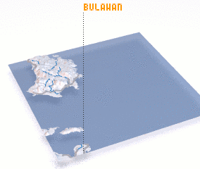 Places with similar names to Bulawan, Philippines ::
Disclaimer :: Information on this page comes without warranty of any kind |
||
|
Where is Bulawan? Elevation and coordinates ::
Latitude (lat): 13°2'0"N Longitude (lon): 124°10'0"E
Elevation (approx.): 22m (map arrows pan, magnifying glasses zoom) |
||
|
Visiting Bulawan? Hotel/Accommodation ::
Book a hotel in Bulawan Travel Guide ::
Buy a travel guide for Philippines rental cars ::
car rental offers GPS waypoint ::
download a GPX waypoint (PoI) of Bulawan for your GPS receiver
|
||