|
search place name
|
||
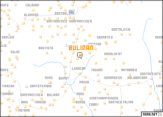
Buliran (Quezon, Philippines)Buliran is a town in the Quezon region of Philippines. An overview map of the region around Buliran is displayed below.
regional and 3d topo map of Buliran, Philippines ::
Buliran airports ::
The nearest airport is MNL - Manila Ninoy Aquino Intl, located 68.2 km north west of Buliran.
Nearby towns ::
Bulakin (0.9km west) //
Bungoy (2.1km north east) //
San Antonio (2.4km north west) //
Lalig (2.5km west) //
Labasin (2.6km north west) //
Lusacan (3.4km south) //
Cabatang (3.4km east) //
Balagbag (3.8km west) //
Dagatan (3.8km north east) //
Tagbakin (4.0km south west) //
Bana (4.0km south west) //
Bula (4.0km south west) //
Callejon (4.0km south west) //
Santa Ana (4.1km north west) //
Santa Cruz (4.2km north) //
Lagalag (4.2km south) //
San Vicente (4.7km north) //
Santisimo Rosario (4.7km west) //
Tiaong (4.9km south west) //
Taguan (5.2km south east) //
Fernando (5.2km south east) //
San Cristobal (5.5km north) //
San Pedro Verdadero (5.4km east) //
San Joaquin (5.8km north) //
Bukal Sur (6.3km south east) //
Paiisa (6.5km south) //
Santo Niño (6.6km north) //
Soledad (6.6km north west) //
Mangahan (6.5km north east) //
[all distances 'as the bird flies' and approximate] 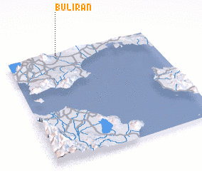 Places with similar names to Buliran, Philippines ::
Disclaimer :: Information on this page comes without warranty of any kind |
||
|
Where is Buliran? Elevation and coordinates ::
Latitude (lat): 13°59'0"N Longitude (lon): 121°21'0"E
Elevation (approx.): 64m (map arrows pan, magnifying glasses zoom) |
||
|
Visiting Buliran? Hotel/Accommodation ::
Book a hotel in Buliran Travel Guide ::
Buy a travel guide for Philippines rental cars ::
car rental offers GPS waypoint ::
download a GPX waypoint (PoI) of Buliran for your GPS receiver
|
||