|
search place name
|
||
Cabangkalan (Bohol, Philippines)Cabangkalan is a town in the Bohol region of Philippines. An overview map of the region around Cabangkalan is displayed below.
regional and 3d topo map of Cabangkalan, Philippines ::

Cabangkalan airports ::
The nearest airport is NOP - Masbate Mactan Cebu Intl, located 46.6 km north west of Cabangkalan.
Other airports nearby include DGT - Dumaguete (143.0 km south west), TAC - Tacloban Daniel Z Romualdez (145.1 km north east), BCD - Bacolod (166.7 km west), CGY - Ladag Cagayan De Oro (188.5 km south), Nearby towns ::
Kasilion (1.9km south) //
Nacon (1.8km east) //
Tagum (1.8km east) //
Trinidad (2.1km south) //
Bugang (2.6km south west) //
Bayongan (2.6km south west) //
Ipil (2.6km south west) //
Cabangahan (2.6km north east) //
San Roque (3.4km west) //
Buyog (3.8km south west) //
Hebale (4.1km north west) //
Cantubod (4.1km north west) //
Capayas (4.1km north west) //
Cataban Island (4.1km north west) //
Tanghaligue (4.1km north west) //
Mahagbu (4.1km south west) //
Naupa (4.1km north east) //
Tagum Sur (4.2km south east) //
Baboy (4.2km north west) //
Bancal (4.4km north east) //
Auyan (4.7km west) //
Loblob (5.2km south west) //
San Isidro (5.3km north west) //
Bien Unido (5.4km north east) //
Guinobatan (5.5km south east) //
Bigot (5.6km west) //
Mabuhay-Cabiguhan (5.8km south) //
Kinanoan (5.9km south) //
Tongo (5.8km north west) //
[all distances 'as the bird flies' and approximate] 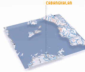 Places with similar names to Cabangkalan, Philippines ::
// Cabangcalan (PH)
// Cabangcalan (PH)
// Cabangcalan (PH)
// Cabangcalan (PH)
// Cabangcalan (PH)
// Cabangkalan (PH)
Disclaimer :: Information on this page comes without warranty of any kind |
||
|
Where is Cabangkalan? Elevation and coordinates ::
Latitude (lat): 10°6'0"N Longitude (lon): 124°21'0"E
Elevation (approx.): 3m (map arrows pan, magnifying glasses zoom) |
||
|
Visiting Cabangkalan? Hotel/Accommodation ::
Book a hotel in Cabangkalan Travel Guide ::
Buy a travel guide for Philippines rental cars ::
car rental offers GPS waypoint ::
download a GPX waypoint (PoI) of Cabangkalan for your GPS receiver
|
||