|
search place name
|
||
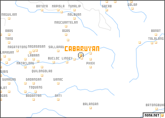
Cabaruyan (Abra, Philippines)Cabaruyan is a town in the Abra region of Philippines. An overview map of the region around Cabaruyan is displayed below.
regional and 3d topo map of Cabaruyan, Philippines ::
Cabaruyan airports ::
The nearest airport is BAG - Baguio, located 123.1 km south of Cabaruyan.
Nearby towns ::
Daguioman (0.2km north west) //
Liñgay (1.8km east) //
Cabaroyan (1.8km west) //
Ableg (2.2km north east) //
Pikek (2.6km south east) //
Liñgey (3.4km west) //
Agasasan (5.3km north west) //
Sal-lapadan (5.6km west) //
Bucloc (6.2km west) //
Agas (6.6km north west) //
Danac (7.7km south west) //
Nagcuartelan (8.2km north west) //
[all distances 'as the bird flies' and approximate] 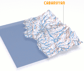
Disclaimer :: Information on this page comes without warranty of any kind |
||
|
Where is Cabaruyan? Elevation and coordinates ::
Latitude (lat): 17°27'0"N Longitude (lon): 120°55'0"E
Elevation (approx.): 514m (map arrows pan, magnifying glasses zoom) |
||
|
Visiting Cabaruyan? Hotel/Accommodation ::
Book a hotel in Cabaruyan Travel Guide ::
Buy a travel guide for Philippines rental cars ::
car rental offers GPS waypoint ::
download a GPX waypoint (PoI) of Cabaruyan for your GPS receiver
|
||