|
search place name
|
||
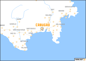
Cabugao (Catanduanes, Philippines)Cabugao is a town in the Catanduanes region of Philippines. An overview map of the region around Cabugao is displayed below.
regional and 3d topo map of Cabugao, Philippines ::
Cabugao airports ::
The nearest airport is KLO - Kalibo, located 296.1 km south west of Cabugao.
Nearby towns ::
San Vicente (1.0km west) //
Sipi (1.8km north east) //
Guinobatan (2.6km east) //
Duag (2.6km east) //
Bato (2.7km east) //
San Vicente (2.9km west) //
Oguis (3.0km north east) //
Cagraray (3.2km north east) //
Tilis (3.2km north east) //
Quiliquilihan (3.2km north east) //
Sibacognan (4.3km north east) //
Batalay (4.4km east) //
Santa Isabel (4.4km east) //
Bote (4.6km east) //
Libjo (4.8km north east) //
San Juan Pequeño (4.8km north east) //
Santo Niño (5.0km west) //
San Miguel (5.4km north east) //
San Roque (5.4km north east) //
Virac (5.4km south west) //
Obo (5.7km north) //
Mabato (5.7km north) //
San Juan Grande (5.8km north east) //
Talisay (5.8km east) //
Patagan (6.2km north east) //
Jilaglabanon (6.2km north east) //
Solong (6.2km north east) //
Danicop (6.4km west) //
Iguang Bayawas (6.5km east) //
[all distances 'as the bird flies' and approximate] 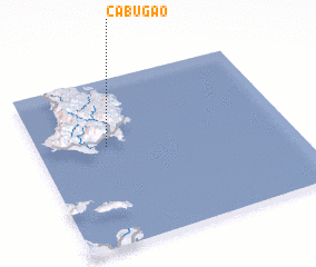 Places with similar names to Cabugao, Philippines ::
Disclaimer :: Information on this page comes without warranty of any kind |
||
|
Where is Cabugao? Elevation and coordinates ::
Latitude (lat): 13°35'57"N Longitude (lon): 124°16'34"E
Elevation (approx.): 24m (map arrows pan, magnifying glasses zoom) |
||
|
Visiting Cabugao? Hotel/Accommodation ::
Book a hotel in Cabugao Travel Guide ::
Buy a travel guide for Philippines rental cars ::
car rental offers GPS waypoint ::
download a GPX waypoint (PoI) of Cabugao for your GPS receiver
|
||