|
search place name
|
||
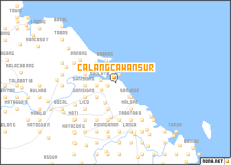
Calangcawan Sur (Camarines Norte, Philippines)Calangcawan Sur is a town in the Camarines Norte region of Philippines. An overview map of the region around Calangcawan Sur is displayed below.
regional and 3d topo map of Calangcawan Sur, Philippines ::
Calangcawan Sur airports ::
The nearest airport is MNL - Manila Ninoy Aquino Intl, located 208.9 km west of Calangcawan Sur.
Nearby towns ::
Calangcawan (1.3km south west) //
Dalipay (1.3km south west) //
Sula (1.4km north east) //
Mancayo (2.3km west) //
Vinzons (2.5km south west) //
Calangcawan Norte (2.6km north) //
Del Carmen (3.1km south east) //
Contod (3.0km west) //
Calaguas (3.0km west) //
San Agustin (3.0km west) //
Balombon (3.0km west) //
Pambanit (3.4km north) //
San Jose (3.4km south east) //
Mancawayan (3.7km south west) //
Sabang (3.8km north west) //
Mandalig (3.8km south west) //
Donsolan (3.8km south west) //
Poctol (4.3km north west) //
Bulacan (4.3km north west) //
Mancruz (4.4km south) //
Cruzcero (4.4km south) //
Lagundi (4.4km south) //
Singi (4.7km north west) //
Malope (4.9km south east) //
San Isidro (4.8km west) //
Cagbalogo (4.8km west) //
Balogo (4.8km west) //
Lagpa (5.0km west) //
Tranca (5.0km west) //
[all distances 'as the bird flies' and approximate] 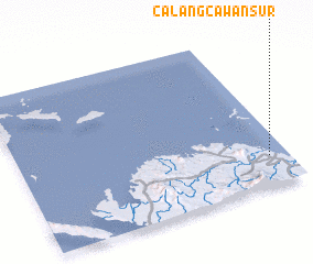 Places with similar names to Calangcawan Sur, Philippines :: Disclaimer :: Information on this page comes without warranty of any kind |
||
|
Where is Calangcawan Sur? Elevation and coordinates ::
Latitude (lat): 14°11'18"N Longitude (lon): 122°55'40"E
Elevation (approx.): -32768m (map arrows pan, magnifying glasses zoom) |
||
|
Visiting Calangcawan Sur? Hotel/Accommodation ::
Book a hotel in Calangcawan Sur Travel Guide ::
Buy a travel guide for Philippines rental cars ::
car rental offers GPS waypoint ::
download a GPX waypoint (PoI) of Calangcawan Sur for your GPS receiver
|
||