|
search place name
|
||
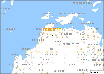
Campicot (Bohol, Philippines)Campicot is a town in the Bohol region of Philippines. An overview map of the region around Campicot is displayed below.
regional and 3d topo map of Campicot, Philippines ::
Campicot airports ::
The nearest airport is NOP - Masbate Mactan Cebu Intl, located 29.5 km north west of Campicot.
Other airports nearby include DGT - Dumaguete (131.2 km south west), BCD - Bacolod (148.4 km north west), TAC - Tacloban Daniel Z Romualdez (152.3 km north east), ILO - Iloilo (190.5 km west), Nearby towns ::
Salog (1.6km north east) //
Bogo (1.8km west) //
Cahicong (1.8km east) //
Cogon (2.1km north west) //
Tulang (3.2km north east) //
Jetafe (3.6km north west) //
Vical (3.6km west) //
Jandayan (3.7km north) //
Cabinong (3.6km east) //
Cangmundo (3.7km south east) //
Saguise (3.8km west) //
Boyog (4.1km south west) //
Pandanon (4.1km north west) //
Saguisinhan (4.1km north east) //
Corte-Baud (5.2km south west) //
Cangmundo (5.5km east) //
Lapad (5.6km south) //
Anonang (5.6km south) //
Aom (5.9km south) //
Tulang (5.8km east) //
Cangomagong (5.9km south) //
Bacsan (6.6km south east) //
Cantores (7.0km south west) //
Cruz (7.0km south west) //
Magtangtang (7.4km south) //
Hobangan (7.4km south) //
Banacon (7.4km north) //
Guilao (7.6km north) //
Cadahon (7.6km east) //
[all distances 'as the bird flies' and approximate]  Places with similar names to Campicot, Philippines ::
// Campaka 3 (ID)
Disclaimer :: Information on this page comes without warranty of any kind |
||
|
Where is Campicot? Elevation and coordinates ::
Latitude (lat): 10°8'0"N Longitude (lon): 124°11'0"E
Elevation (approx.): 8m (map arrows pan, magnifying glasses zoom) |
||
|
Visiting Campicot? Hotel/Accommodation ::
Book a hotel in Campicot Travel Guide ::
Buy a travel guide for Philippines rental cars ::
car rental offers GPS waypoint ::
download a GPX waypoint (PoI) of Campicot for your GPS receiver
|
||