|
search place name
|
||
Canongo (Masbate, Philippines)Canongo is a town in the Masbate region of Philippines. An overview map of the region around Canongo is displayed below.
regional and 3d topo map of Canongo, Philippines ::

Canongo airports ::
The nearest airport is KLO - Kalibo, located 173.5 km south west of Canongo.
Other airports nearby include TAC - Tacloban Daniel Z Romualdez (212.2 km south east), BCD - Bacolod (231.0 km south), ILO - Iloilo (241.9 km south west), SJI - San Jose Antique (277.2 km south west), Nearby towns ::
Camitobitohan (0.0km north) //
Jagnaan (0.6km north west) //
Bagahanglad (0.7km south east) //
Madarag (1.9km south) //
Bagaguimbal (1.9km north) //
Cuyap (2.3km north) //
San Roque (2.6km north east) //
Bagaguimbal (2.6km north west) //
Salog (2.6km south west) //
Dobdoh (2.7km east) //
Nagcaagao (3.7km south) //
Bagasico (3.7km north) //
Tomboron (3.7km north) //
Jagna (3.6km west) //
Tanag (3.6km west) //
Magdaran (3.6km west) //
Toquip (4.0km south west) //
Liac (4.1km north west) //
Igjod (4.1km north east) //
Baladingan (4.1km north east) //
Tagdogan (4.1km north east) //
Natunauan (4.1km north west) //
Calpi (4.1km south west) //
Cantorna (4.2km west) //
Labongan (4.4km south) //
Rizal (4.6km east) //
Famosa (4.7km north east) //
Monreal (4.9km north) //
Lenabungan (5.0km north west) //
[all distances 'as the bird flies' and approximate] 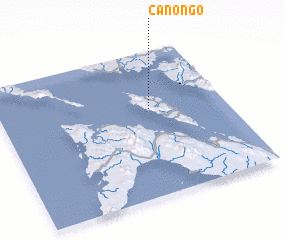 Places with similar names to Canongo, Philippines ::
Disclaimer :: Information on this page comes without warranty of any kind |
||
|
Where is Canongo? Elevation and coordinates ::
Latitude (lat): 12°36'0"N Longitude (lon): 123°40'0"E
Elevation (approx.): 78m (map arrows pan, magnifying glasses zoom) |
||
|
Visiting Canongo? Hotel/Accommodation ::
Book a hotel in Canongo Travel Guide ::
Buy a travel guide for Philippines rental cars ::
car rental offers GPS waypoint ::
download a GPX waypoint (PoI) of Canongo for your GPS receiver
|
||