|
search place name
|
||
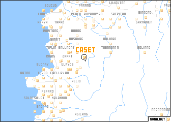
Caset (Ilocos Sur, Philippines)Caset is a town in the Ilocos Sur region of Philippines. An overview map of the region around Caset is displayed below.
regional and 3d topo map of Caset, Philippines ::
Caset airports ::
The nearest airport is BAG - Baguio, located 161.8 km south of Caset.
Nearby towns ::
Zapat (1.8km west) //
Tubigay (1.8km west) //
Salan (1.8km south west) //
Napid (2.6km south west) //
Quibitquibit (2.6km north west) //
Batan (3.1km south west) //
Nagungburan (3.3km north) //
Zapat (3.5km west) //
Supit (3.5km west) //
Nagsantaan (3.6km south west) //
Duyayat (3.6km north west) //
Kasar (4.0km south west) //
Karkarsi (4.0km south west) //
Ulayos (4.0km south west) //
Masadag (4.1km north west) //
Calingayan (4.0km north west) //
Sallacapo (4.0km north west) //
Zapat (4.9km west) //
Maradudon (5.1km south west) //
Katucdaan (5.1km south west) //
Kakarsi (5.1km south west) //
Sangan (5.1km south west) //
Nagbalioartian (5.1km north west) //
Passis (5.1km north west) //
Zapat (5.3km west) //
Tibangran (5.6km east) //
Pelid (5.8km south) //
San Carlos (5.8km north) //
Ubbog (5.8km north) //
[all distances 'as the bird flies' and approximate] 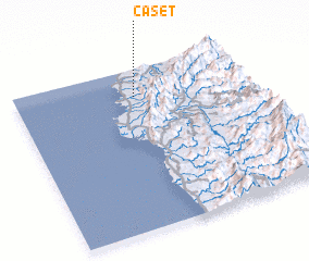 Places with similar names to Caset, Philippines ::
Disclaimer :: Information on this page comes without warranty of any kind |
||
|
Where is Caset? Elevation and coordinates ::
Latitude (lat): 17°50'0"N Longitude (lon): 120°31'0"E
Elevation (approx.): 204m (map arrows pan, magnifying glasses zoom) |
||
|
Visiting Caset? Hotel/Accommodation ::
Book a hotel in Caset Travel Guide ::
Buy a travel guide for Philippines rental cars ::
car rental offers GPS waypoint ::
download a GPX waypoint (PoI) of Caset for your GPS receiver
|
||