|
search place name
|
||
Daho (Sulu, Philippines)Daho is a town in the Sulu region of Philippines. An overview map of the region around Daho is displayed below.
regional and 3d topo map of Daho, Philippines ::

Daho airports ::
The nearest airport is ZAM - Zamboanga Intl, located 180.6 km north east of Daho.
Nearby towns ::
Parisan (0.3km north west) //
Tabukan (0.6km north) //
Luma Dapdap (0.8km south west) //
Dahagan (0.9km south west) //
Kataan (1.0km north) //
Salimbangan (1.2km south) //
Panitikan (1.3km west) //
Lugastaun (1.3km south east) //
Gabon (1.4km north west) //
Kabugan (1.4km east) //
Langab (1.5km north east) //
Punnon (1.5km north) //
Singkab (1.6km north east) //
Bankilay (1.8km north east) //
Darian Batang (1.9km south east) //
Kabungkagan (2.0km north west) //
Lood (2.0km north east) //
Sula (2.2km north) //
Simigang (2.2km west) //
Tubig (2.2km west) //
Langus (2.3km north east) //
Panitikan (2.4km north east) //
Dalau (2.5km north east) //
Bas (2.6km east) //
Lublubah (2.6km west) //
Tong Bas (2.6km south east) //
Simundang (2.8km north west) //
Sicumbang (2.8km north west) //
Pandan Niog (2.9km south) //
[all distances 'as the bird flies' and approximate] 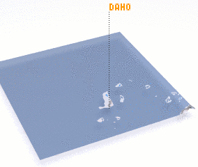 Places with similar names to Daho, Philippines ::
Disclaimer :: Information on this page comes without warranty of any kind |
||
|
Where is Daho? Elevation and coordinates ::
Latitude (lat): 6°16'31"N Longitude (lon): 120°33'36"E
Elevation (approx.): 11m (map arrows pan, magnifying glasses zoom) |
||
|
Visiting Daho? Hotel/Accommodation ::
Book a hotel in Daho Travel Guide ::
Buy a travel guide for Philippines rental cars ::
car rental offers GPS waypoint ::
download a GPX waypoint (PoI) of Daho for your GPS receiver
|
||