|
search place name
|
||
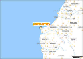
Darigayos (La Union, Philippines)Darigayos is a town in the La Union region of Philippines. An overview map of the region around Darigayos is displayed below.
regional and 3d topo map of Darigayos, Philippines ::
Darigayos airports ::
The nearest airport is BAG - Baguio, located 59.2 km south east of Darigayos.
Nearby towns ::
Nalvo Sur (0.0km north) //
Paraoir (1.3km south) //
Carisquis (1.8km east) //
Nalvo Norte (2.6km north east) //
Pila (3.2km east) //
Ayaoan (3.5km south east) //
Sucoc Norte (3.5km east) //
Bungro (3.5km east) //
Sucoc Sur (3.5km east) //
Mamay (3.5km east) //
Cabalitocan (3.9km south east) //
Nagallaoat (4.1km south east) //
Santa Isabel (4.1km south east) //
Magsiping (4.0km south east) //
Magallanes (4.0km north east) //
Barrientos (4.6km north east) //
Tallaoen (5.3km east) //
Nagrebcan (5.3km east) //
Luna (5.6km north east) //
Pagbennecan (5.6km east) //
Paagan (5.8km south) //
Bunga (5.8km south) //
Carcarmay (5.8km south) //
Santo Domingo Sur (5.6km east) //
Rissing (5.6km east) //
Barangobong (5.6km east) //
Buselbusel (5.6km east) //
Suyo (5.6km east) //
Nagsabaran Sur (6.5km south east) //
[all distances 'as the bird flies' and approximate]  Places with similar names to Darigayos, Philippines :: Disclaimer :: Information on this page comes without warranty of any kind |
||
|
Where is Darigayos? Elevation and coordinates ::
Latitude (lat): 16°50'0"N Longitude (lon): 120°20'0"E
Elevation (approx.): -32768m (map arrows pan, magnifying glasses zoom) |
||
|
Visiting Darigayos? Hotel/Accommodation ::
Book a hotel in Darigayos Travel Guide ::
Buy a travel guide for Philippines rental cars ::
car rental offers GPS waypoint ::
download a GPX waypoint (PoI) of Darigayos for your GPS receiver
|
||