|
search place name
|
||
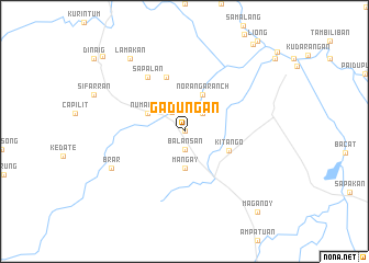
Gaduñgan (Maguindanao, Philippines)Gaduñgan is a town in the Maguindanao region of Philippines. An overview map of the region around Gaduñgan is displayed below.
regional and 3d topo map of Gaduñgan, Philippines ::
Gaduñgan airports ::
The nearest airport is CEB - Cebu Cotabato, located 30.4 km north west of Gaduñgan.
Other airports nearby include LGP - Legazpi Pagadian (140.9 km north west), CGY - Ladag Cagayan De Oro (161.9 km north), Nearby towns ::
Dalican (0.0km north) //
Balansan (1.9km south) //
Talayan (2.3km north west) //
Katipuan (2.6km north east) //
Mangay (3.7km south) //
Numangan (4.1km north west) //
Noranga Ranch (4.1km north east) //
Kitango (4.9km south east) //
Ceturan (5.9km north) //
Dalto Hunangan (6.7km north west) //
Sapalan (6.7km north west) //
Brar (8.2km south west) //
Lamakan (9.2km north west) //
Maganoy (11.0km south east) //
Dalican (11.2km north west) //
[all distances 'as the bird flies' and approximate] 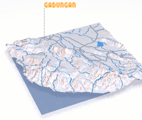 Places with similar names to Gaduñgan, Philippines ::
// Caddangan (PH)
// Cataiñgan (PH)
// Catan-agan (PH)
// Catanagan (PH)
// Catanagan (PH)
// Catengan (PH)
// Catungan (PH)
// Catungan (PH)
// Catungan (PH)
// Catungauan (PH)
Disclaimer :: Information on this page comes without warranty of any kind |
||
|
Where is Gaduñgan? Elevation and coordinates ::
Latitude (lat): 6°58'0"N Longitude (lon): 124°24'0"E
Elevation (approx.): 33m (map arrows pan, magnifying glasses zoom) |
||
|
Visiting Gaduñgan? Hotel/Accommodation ::
Book a hotel in Gaduñgan Travel Guide ::
Buy a travel guide for Philippines rental cars ::
car rental offers GPS waypoint ::
download a GPX waypoint (PoI) of Gaduñgan for your GPS receiver
|
||