|
search place name
|
||
Gambar (Maguindanao, Philippines)Gambar is a town in the Maguindanao region of Philippines. An overview map of the region around Gambar is displayed below.
regional and 3d topo map of Gambar, Philippines ::

Gambar airports ::
The nearest airport is CEB - Cebu Cotabato, located 18.3 km west of Gambar.
Other airports nearby include LGP - Legazpi Pagadian (125.4 km north west), CGY - Ladag Cagayan De Oro (141.5 km north), Nearby towns ::
Datu Gumoungan (1.4km north west) //
Bubug (2.5km north) //
Pagaluñgan (2.9km south) //
Nipein (2.9km south) //
Tumaguinting (3.0km south east) //
Matilao (3.9km south east) //
Ganta (3.9km south east) //
Libuñgan (4.7km south) //
Dapilican (4.7km south) //
Falacoco Sultania (4.7km south) //
Tuka-na-Butiren (5.3km south east) //
Lañgaban (5.3km south east) //
Pened (5.3km south east) //
Badak (5.3km south east) //
Misaua (5.3km south east) //
Kalukalu (5.3km south east) //
Matilac (5.3km south east) //
Bongued (5.3km south east) //
Bagumbayan (5.3km south east) //
Pagueda (5.3km south east) //
Katidtuan (5.3km south east) //
Payan (5.3km south east) //
San Juan Rancheria (5.4km south west) //
Tumbao (5.8km south) //
Dadtumeg (6.5km south) //
Mastuta (6.6km north west) //
Matun (7.0km south east) //
Taviran (7.0km south west) //
Gago Rancheria (7.1km south west) //
[all distances 'as the bird flies' and approximate] 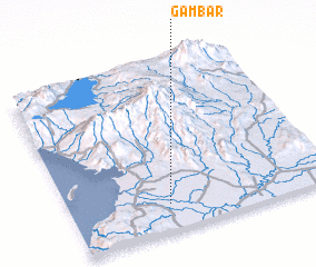 Places with similar names to Gambar, Philippines ::
Disclaimer :: Information on this page comes without warranty of any kind |
||
|
Where is Gambar? Elevation and coordinates ::
Latitude (lat): 7°9'29"N Longitude (lon): 124°22'32"E
Elevation (approx.): 4m (map arrows pan, magnifying glasses zoom) |
||
|
Visiting Gambar? Hotel/Accommodation ::
Book a hotel in Gambar Travel Guide ::
Buy a travel guide for Philippines rental cars ::
car rental offers GPS waypoint ::
download a GPX waypoint (PoI) of Gambar for your GPS receiver
|
||