|
search place name
|
||
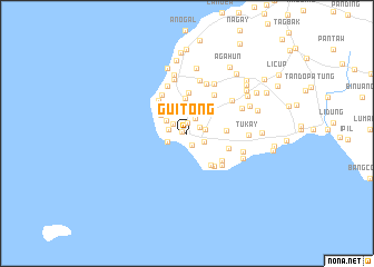
Guitong (Sulu, Philippines)Guitong is a town in the Sulu region of Philippines. An overview map of the region around Guitong is displayed below.
regional and 3d topo map of Guitong, Philippines ::
Guitong airports ::
The nearest airport is ZAM - Zamboanga Intl, located 169.1 km north east of Guitong.
Nearby towns ::
Kanaway (0.5km north west) //
Lupa Abu (1.0km north) //
Parang (1.3km south east) //
Laum Suah (1.4km north east) //
Tumangas (1.7km north west) //
Saldang (1.7km north east) //
Tandu Bunga (1.8km west) //
Tikong (1.8km east) //
Tambun (1.9km south east) //
Lanaw Dakula' (1.9km south east) //
Babag (1.9km south east) //
Kahuy Sina' (1.9km south east) //
Buli' Bawang (1.9km south east) //
Bid (1.9km south east) //
Payuhan (1.9km north) //
Lapac (2.2km south west) //
Bawisan (2.4km north west) //
Wanni Pianjihan (2.8km north east) //
Sampunay (2.9km north) //
Subatandu (3.2km north west) //
Layag-Layag (3.3km north west) //
Biid (3.4km north east) //
Panko (3.5km north west) //
Alu (3.5km north) //
Linuho (3.9km east) //
Loas (4.0km south east) //
Piahan (4.1km north) //
Batobato (4.3km south east) //
Malopa (4.3km north west) //
[all distances 'as the bird flies' and approximate]  Places with similar names to Guitong, Philippines ::
Disclaimer :: Information on this page comes without warranty of any kind |
||
|
Where is Guitong? Elevation and coordinates ::
Latitude (lat): 5°55'27"N Longitude (lon): 120°54'5"E
Elevation (approx.): 23m (map arrows pan, magnifying glasses zoom) |
||
|
Visiting Guitong? Hotel/Accommodation ::
Book a hotel in Guitong Travel Guide ::
Buy a travel guide for Philippines rental cars ::
car rental offers GPS waypoint ::
download a GPX waypoint (PoI) of Guitong for your GPS receiver
|
||