|
search place name
|
||
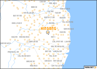
Hindang (Leyte, Philippines)Hindang is a town in the Leyte region of Philippines. An overview map of the region around Hindang is displayed below.
regional and 3d topo map of Hindang, Philippines ::
Hindang airports ::
The nearest airport is TAC - Tacloban Daniel Z Romualdez, located 26.0 km north of Hindang.
Other airports nearby include NOP - Masbate Mactan Cebu Intl (132.4 km south west), DGT - Dumaguete (259.4 km south west), Nearby towns ::
Balingasag (1.2km north) //
Bolongtohan (1.8km east) //
Bungdo (2.1km north east) //
Aslom (2.4km north west) //
Canmangui (2.6km south east) //
Mat-i (2.6km south east) //
Calbasag (2.6km south west) //
Tangnan (2.6km south west) //
Kanmonhag (2.8km north) //
Julita (2.9km south) //
Anibong (2.9km east) //
Libas (3.1km west) //
Cambacao (3.6km west) //
Pikas (3.7km north) //
Gitabla (3.6km east) //
Mojon (3.7km south) //
Tigbao (3.9km east) //
Jabong (4.0km north west) //
San Vicente (4.1km north east) //
San Gabriel (4.0km west) //
Kiloon (4.1km north east) //
Tigbaw (4.1km north east) //
Catanbuan (4.1km north east) //
Cabagtan (4.1km south west) //
San Pablo (4.1km south west) //
Tabuanon (4.1km north west) //
Tagungtong (4.1km north west) //
Capaculian (4.2km north west) //
Tabontabon (4.6km north) //
[all distances 'as the bird flies' and approximate]  Places with similar names to Hindang, Philippines ::
// Handong (PH)
// Hindang (PH)
// Hindang (PH)
// Hindang (PH)
// Hinding (AT)
// Whenuatonga (NZ)
// Huandunga (PE)
// Hanae-dong (KP)
// Hanae-dong (KP)
// Hanae-dong (KP)
Disclaimer :: Information on this page comes without warranty of any kind |
||
|
Where is Hindang? Elevation and coordinates ::
Latitude (lat): 11°0'0"N Longitude (lon): 124°58'0"E
Elevation (approx.): 22m (map arrows pan, magnifying glasses zoom) |
||
|
Visiting Hindang? Hotel/Accommodation ::
Book a hotel in Hindang Travel Guide ::
Buy a travel guide for Philippines rental cars ::
car rental offers GPS waypoint ::
download a GPX waypoint (PoI) of Hindang for your GPS receiver
|
||