|
search place name
|
||
Igcabidio (Iloilo, Philippines)Igcabidio is a town in the Iloilo region of Philippines. An overview map of the region around Igcabidio is displayed below.
regional and 3d topo map of Igcabidio, Philippines ::

Igcabidio airports ::
The nearest airport is SJI - San Jose Antique, located 29.4 km north west of Igcabidio.
Other airports nearby include ILO - Iloilo (42.4 km east), BCD - Bacolod (83.5 km east), KLO - Kalibo (118.0 km north), DGT - Dumaguete (190.0 km south east), Nearby towns ::
Taslan (0.0km north) //
Lomboy (0.0km north) //
San Rafael (1.8km south east) //
Narat-an Igtuba (1.9km south) //
Oyuñgan (1.8km east) //
Boñga (1.8km west) //
Ginot-an (1.9km north) //
Oyungan (2.2km south east) //
Danawan (2.6km north) //
Huná (2.6km south west) //
Guibongan Bayunan (2.7km south) //
Damilisan (3.1km east) //
Tapikan (3.4km south west) //
Manhara (3.7km south) //
Tabunacan (3.6km east) //
Palaca (3.6km east) //
San Francisco (3.6km west) //
Roma (3.6km west) //
Igdagmay (3.7km north) //
Bacolod (3.7km north) //
Paro-on (4.0km north) //
San Rafael (4.1km north east) //
Igcabito-on (4.1km north west) //
Sag-on (4.4km north east) //
San Roque (4.6km east) //
Agdum (5.2km north east) //
Nadsadan (5.3km north west) //
Dalije (5.6km north) //
Toog (5.7km north) //
[all distances 'as the bird flies' and approximate] 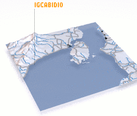 Places with similar names to Igcabidio, Philippines ::
// Igcabuad (PH)
Disclaimer :: Information on this page comes without warranty of any kind |
||
|
Where is Igcabidio? Elevation and coordinates ::
Latitude (lat): 10°38'0"N Longitude (lon): 122°10'0"E
Elevation (approx.): 46m (map arrows pan, magnifying glasses zoom) |
||
|
Visiting Igcabidio? Hotel/Accommodation ::
Book a hotel in Igcabidio Travel Guide ::
Buy a travel guide for Philippines rental cars ::
car rental offers GPS waypoint ::
download a GPX waypoint (PoI) of Igcabidio for your GPS receiver
|
||