|
search place name
|
||
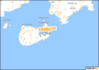
Kamawi (Sulu, Philippines)Kamawi is a town in the Sulu region of Philippines. An overview map of the region around Kamawi is displayed below.
regional and 3d topo map of Kamawi, Philippines ::
Kamawi airports ::
The nearest airport is ZAM - Zamboanga Intl, located 152.4 km north east of Kamawi.
Nearby towns ::
Kamawi (1.6km west) //
Daungdong (2.7km north) //
Tanquique (2.9km south west) //
Taytayan (3.2km west) //
Kalanpang (3.8km west) //
Kaonpong (4.0km west) //
Pongdong (4.1km north west) //
Manaling (4.7km west) //
Bonin (5.7km south west) //
Paragon (5.7km west) //
Tambulian (5.8km north) //
Likud (6.3km south west) //
Kawayan (6.5km north west) //
Kawayan (6.8km west) //
Sangkap (6.9km west) //
Bulampora (7.1km west) //
Sang (7.2km north east) //
Andalan (7.4km west) //
Niug Niug (7.8km west) //
Karungdung (7.9km north east) //
Kanjarang (7.9km west) //
Sungab (8.5km north east) //
Bowol (8.6km north) //
Tubig Dapdap (8.6km west) //
Pandanpandan (8.7km north) //
Bunan (8.7km north) //
Pisak Pisak (8.7km west) //
Kalingalan Caluang (8.8km north east) //
Siyunuyan (8.9km north) //
[all distances 'as the bird flies' and approximate] 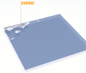 Places with similar names to Kamawi, Philippines ::
Disclaimer :: Information on this page comes without warranty of any kind |
||
|
Where is Kamawi? Elevation and coordinates ::
Latitude (lat): 5°49'4"N Longitude (lon): 121°14'7"E
Elevation (approx.): -32768m (map arrows pan, magnifying glasses zoom) |
||
|
Visiting Kamawi? Hotel/Accommodation ::
Book a hotel in Kamawi Travel Guide ::
Buy a travel guide for Philippines rental cars ::
car rental offers GPS waypoint ::
download a GPX waypoint (PoI) of Kamawi for your GPS receiver
|
||