|
search place name
|
||
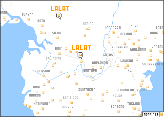
Lalat (Zamboanga del Sur, Philippines)Lalat is a town in the Zamboanga del Sur region of Philippines. An overview map of the region around Lalat is displayed below.
regional and 3d topo map of Lalat, Philippines ::
Lalat airports ::
The nearest airport is LGP - Legazpi Pagadian, located 62.4 km east of Lalat.
Other airports nearby include ZAM - Zamboanga Intl (126.3 km south west), CEB - Cebu Cotabato (154.5 km east), DGT - Dumaguete (187.3 km north), CGY - Ladag Cagayan De Oro (204.1 km north east), Nearby towns ::
Ganyangan (0.8km south) //
Marasingan (2.0km north west) //
Coloran (3.0km north west) //
Timuay Pinto (3.2km south east) //
Lamponac (3.8km south west) //
Labasan (4.3km north west) //
Sante Fe (4.3km south east) //
Daplahan (4.8km south east) //
Lapirian (5.0km south west) //
Balucanan (5.2km west) //
Nanan (5.3km south west) //
Daplahan Junction (5.3km north) //
Sibuguey (5.4km south east) //
Siay (5.4km west) //
Lagting (5.7km south west) //
Mountain View (5.9km south) //
Gatos (6.1km east) //
Salinding (6.4km west) //
Camanga (6.8km north) //
Sibuguey (6.8km west) //
Manina (7.1km north) //
Sunacuya (7.3km north east) //
Siloh (7.3km north west) //
Lumbog (7.8km east) //
Lindang (7.9km north east) //
Guintocan (8.3km south) //
Little Baguio (8.3km east) //
Kauswagan (8.6km east) //
Tinuntungas (8.6km north east) //
[all distances 'as the bird flies' and approximate] 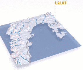 Places with similar names to Lalat, Philippines ::
Disclaimer :: Information on this page comes without warranty of any kind |
||
|
Where is Lalat? Elevation and coordinates ::
Latitude (lat): 7°41'8"N Longitude (lon): 122°54'40"E
Elevation (approx.): 24m (map arrows pan, magnifying glasses zoom) |
||
|
Visiting Lalat? Hotel/Accommodation ::
Book a hotel in Lalat Travel Guide ::
Buy a travel guide for Philippines rental cars ::
car rental offers GPS waypoint ::
download a GPX waypoint (PoI) of Lalat for your GPS receiver
|
||