|
search place name
|
||
Lañgub (Philippines)Lañgub is a town in Philippines. An overview map of the region around Lañgub is displayed below.
regional and 3d topo map of Lañgub, Philippines ::

Lañgub airports ::
The nearest airport is BCD - Bacolod, located 72.8 km west of Lañgub.
Other airports nearby include NOP - Masbate Mactan Cebu Intl (73.6 km south east), ILO - Iloilo (112.5 km west), KLO - Kalibo (160.2 km north west), TAC - Tacloban Daniel Z Romualdez (165.5 km east), Nearby towns ::
General Luna (0.0km north) //
Libertad (0.0km north) //
Old Escalante (0.8km north west) //
Cansimbug (1.8km west) //
Dian-ay (1.8km west) //
Banquerohan (2.0km south west) //
Danao (2.6km south west) //
Buenavista (3.7km south) //
Valdez (4.1km south west) //
Cagay (4.1km south west) //
Alimango (4.7km west) //
Langub (5.1km south west) //
Rizal (5.4km south) //
Washington (5.4km north west) //
Balintawak (7.0km west) //
Udtongan (7.1km south west) //
Cervantes (7.1km north west) //
Escalante (7.4km west) //
Guintungan (8.3km south west) //
Macabug (8.2km north west) //
Japitan (8.4km south) //
Vito (9.9km north west) //
Plaridel (11.0km north west) //
[all distances 'as the bird flies' and approximate] 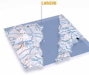 Places with similar names to Lañgub, Philippines ::
Disclaimer :: Information on this page comes without warranty of any kind |
||
|
Where is Lañgub? Elevation and coordinates ::
Latitude (lat): 10°50'0"N Longitude (lon): 123°34'0"E
Elevation (approx.): -32768m (map arrows pan, magnifying glasses zoom) |
||
|
Visiting Lañgub? Hotel/Accommodation ::
Book a hotel in Lañgub Travel Guide ::
Buy a travel guide for Philippines rental cars ::
car rental offers GPS waypoint ::
download a GPX waypoint (PoI) of Lañgub for your GPS receiver
|
||