|
search place name
|
||
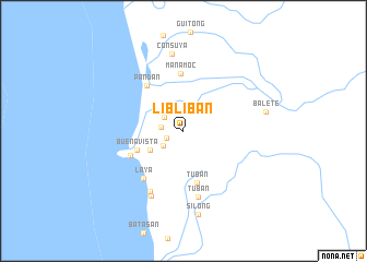
Libliban (Mindoro Occidental, Philippines)Libliban is a town in the Mindoro Occidental region of Philippines. An overview map of the region around Libliban is displayed below.
regional and 3d topo map of Libliban, Philippines ::
Libliban airports ::
The nearest airport is MNL - Manila Ninoy Aquino Intl, located 183.6 km north of Libliban.
Other airports nearby include KLO - Kalibo (213.8 km south east), Nearby towns ::
Angolon (1.8km south west) //
Bisay (2.2km west) //
Ibod (2.3km north west) //
Colaong (2.5km south west) //
Tulaong (3.9km south west) //
Buenavista (5.0km south west) //
Tuban (5.4km south) //
Manamoc (5.8km north) //
Pandan (5.9km north west) //
Sablayan (5.9km south west) //
Laya (6.3km south west) //
Tuban (6.9km south) //
Tuburan (7.0km south west) //
Lulo (7.4km south west) //
Consuya (8.0km north) //
Balete (8.5km east) //
Silong (8.7km south) //
[all distances 'as the bird flies' and approximate] 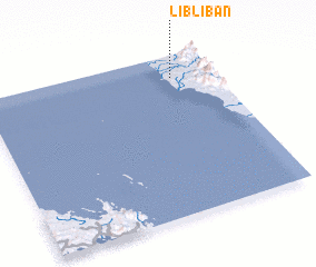 Places with similar names to Libliban, Philippines ::
// Lubluban (PH)
// Laboulbène (FR)
Disclaimer :: Information on this page comes without warranty of any kind |
||
|
Where is Libliban? Elevation and coordinates ::
Latitude (lat): 12°51'38"N Longitude (lon): 120°49'13"E
Elevation (approx.): 22m (map arrows pan, magnifying glasses zoom) |
||
|
Visiting Libliban? Hotel/Accommodation ::
Book a hotel in Libliban Travel Guide ::
Buy a travel guide for Philippines rental cars ::
car rental offers GPS waypoint ::
download a GPX waypoint (PoI) of Libliban for your GPS receiver
|
||