|
search place name
|
||
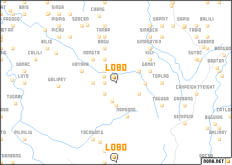
Lobo (Benguet, Philippines)Lobo is a town in the Benguet region of Philippines. An overview map of the region around Lobo is displayed below.
regional and 3d topo map of Lobo, Philippines ::
Lobo airports ::
The nearest airport is BAG - Baguio, located 45.7 km south of Lobo.
Nearby towns ::
Nametha (1.8km west) //
Bakun (2.2km north west) //
Malyeng (2.6km south west) //
Dalingoan (2.6km north west) //
Pangpang (3.2km south) //
Sinacbat (3.5km west) //
Palina (3.7km south) //
Liaong (4.0km south east) //
Cayabayan (4.0km south east) //
Duang (4.1km north west) //
Dalipey (4.0km north east) //
Ampusuñgan (4.5km east) //
Mangta (5.1km north west) //
Bagu (5.8km north) //
Bellang (5.6km east) //
Napsong (5.8km south) //
Gamat (5.6km east) //
Kayapa (5.6km west) //
Kili (6.5km north east) //
Toplao (7.1km east) //
Tanap (7.6km north) //
Barbarit (7.6km north) //
Dinasayan (7.7km north east) //
Bino (7.9km north) //
Bagtangan (8.0km south east) //
Taguda (8.0km south east) //
Sinadca (9.1km north east) //
Limu (10.3km north west) //
Gaftug (10.3km north east) //
[all distances 'as the bird flies' and approximate]  Places with similar names to Lobo, Philippines ::
Disclaimer :: Information on this page comes without warranty of any kind |
||
|
Where is Lobo? Elevation and coordinates ::
Latitude (lat): 16°47'0"N Longitude (lon): 120°41'0"E
Elevation (approx.): 1991m (map arrows pan, magnifying glasses zoom) |
||
|
Visiting Lobo? Hotel/Accommodation ::
Book a hotel in Lobo Travel Guide ::
Buy a travel guide for Philippines rental cars ::
car rental offers GPS waypoint ::
download a GPX waypoint (PoI) of Lobo for your GPS receiver
|
||