|
search place name
|
||
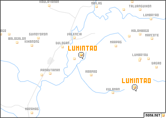
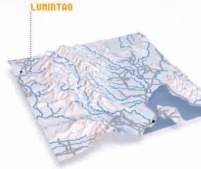
Lumintao (Bukidnon, Philippines)Lumintao is a town in the Bukidnon region of Philippines. An overview map of the region around Lumintao is displayed below.
regional and 3d topo map of Lumintao, Philippines ::
Lumintao airports ::
The nearest airport is CGY - Ladag Cagayan De Oro, located 82.4 km north west of Lumintao.
Other airports nearby include CEB - Cebu Cotabato (126.6 km south west), LGP - Legazpi Pagadian (182.9 km west), DGT - Dumaguete (257.5 km north west), Nearby towns ::
 Places with similar names to Lumintao, Philippines ::
Disclaimer :: Information on this page comes without warranty of any kind |
||
|
Where is Lumintao? Elevation and coordinates ::
Latitude (lat): 7°52'0"N Longitude (lon): 125°7'0"E
Elevation (approx.): 301m (map arrows pan, magnifying glasses zoom) |
||
|
Visiting Lumintao? Hotel/Accommodation ::
Book a hotel in Lumintao Travel Guide ::
Buy a travel guide for Philippines rental cars ::
car rental offers GPS waypoint ::
download a GPX waypoint (PoI) of Lumintao for your GPS receiver
|
||