|
search place name
|
||
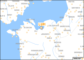
Lupi (Sorsogon, Philippines)Lupi is a town in the Sorsogon region of Philippines. An overview map of the region around Lupi is displayed below.
regional and 3d topo map of Lupi, Philippines ::
Lupi airports ::
The nearest airport is KLO - Kalibo, located 212.9 km south west of Lupi.
Other airports nearby include TAC - Tacloban Daniel Z Romualdez (214.7 km south east), Nearby towns ::
Biriran (3.1km north east) //
Pili (3.0km south west) //
Jagusara (3.3km south east) //
Lajong (3.6km east) //
Catanusan (4.5km south east) //
Taboc (5.0km east) //
Calmayon (5.3km east) //
Binanuahan (5.3km east) //
Buraburan (5.3km east) //
Calateo (5.3km east) //
Cavite (5.3km east) //
Cogon (5.3km east) //
Ilawod (5.3km east) //
Putingsapa (5.3km east) //
Salvacion (5.3km east) //
Taligna (5.3km east) //
Tampi (5.3km east) //
Tughan (5.3km east) //
Calle Nueva (5.3km east) //
Juban (5.7km east) //
Maalo (5.9km south east) //
Catanagan (5.9km east) //
Incarizan (5.9km west) //
Sablayan (6.0km north west) //
Bacalon (6.6km west) //
Guruyan (7.1km south east) //
Añog (7.1km south east) //
Mahalnas (7.1km north west) //
Lugnib (7.5km east) //
[all distances 'as the bird flies' and approximate] 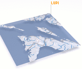 Places with similar names to Lupi, Philippines ::
Disclaimer :: Information on this page comes without warranty of any kind |
||
|
Where is Lupi? Elevation and coordinates ::
Latitude (lat): 12°50'34"N Longitude (lon): 123°56'6"E
Elevation (approx.): 14m (map arrows pan, magnifying glasses zoom) |
||
|
Visiting Lupi? Hotel/Accommodation ::
Book a hotel in Lupi Travel Guide ::
Buy a travel guide for Philippines rental cars ::
car rental offers GPS waypoint ::
download a GPX waypoint (PoI) of Lupi for your GPS receiver
|
||