|
search place name
|
||
Madaging (Misamis Oriental, Philippines)Madaging is a town in the Misamis Oriental region of Philippines. An overview map of the region around Madaging is displayed below.
regional and 3d topo map of Madaging, Philippines ::

Madaging airports ::
The nearest airport is CGY - Ladag Cagayan De Oro, located 40.8 km south west of Madaging.
Other airports nearby include CEB - Cebu Cotabato (182.2 km south west), LGP - Legazpi Pagadian (182.2 km south west), DGT - Dumaguete (188.3 km north west), NOP - Masbate Mactan Cebu Intl (206.1 km north west), Nearby towns ::
Rizal (2.2km south) //
Tamboboan (2.4km east) //
Panampawan (2.7km north east) //
Hinapalanan (3.5km south) //
Kiagawan (3.7km west) //
San Juan (4.1km north) //
Solana (5.0km west) //
Ani-e (6.5km south) //
Plaridel (6.5km west) //
Claveria (7.1km south) //
Guma-od (7.2km west) //
Patrocinio (7.5km south west) //
Rosario (8.4km north west) //
Lanisi (8.6km south east) //
Biasong (9.6km north west) //
San Isidro (11.6km north west) //
[all distances 'as the bird flies' and approximate] 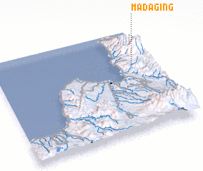 Places with similar names to Madaging, Philippines ::
Disclaimer :: Information on this page comes without warranty of any kind |
||
|
Where is Madaging? Elevation and coordinates ::
Latitude (lat): 8°40'18"N Longitude (lon): 124°52'43"E
Elevation (approx.): 748m (map arrows pan, magnifying glasses zoom) |
||
|
Visiting Madaging? Hotel/Accommodation ::
Book a hotel in Madaging Travel Guide ::
Buy a travel guide for Philippines rental cars ::
car rental offers GPS waypoint ::
download a GPX waypoint (PoI) of Madaging for your GPS receiver
|
||