|
search place name
|
||
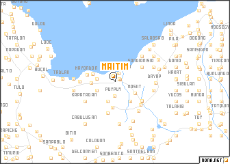
Maitim (Laguna, Philippines)Maitim is a town in the Laguna region of Philippines. An overview map of the region around Maitim is displayed below.
regional and 3d topo map of Maitim, Philippines ::
Maitim airports ::
The nearest airport is MNL - Manila Ninoy Aquino Intl, located 45.8 km north west of Maitim.
Nearby towns ::
San Isidro (0.8km north east) //
Calo (0.8km north east) //
Dila (0.8km north east) //
Bay (0.9km north east) //
San Antonio (1.5km north east) //
Puypuy (2.3km south) //
Maahas (2.9km west) //
San Antonio (2.9km west) //
San Antonio (3.2km south west) //
Tranca (3.4km south) //
Masiit (3.7km south east) //
Bayog (3.7km west) //
Batong Malake (3.7km west) //
Mabacan (4.1km south east) //
Masaya (4.2km south) //
Mayondon (4.5km west) //
San Dionisio (4.9km north east) //
San Benito (4.9km north east) //
Franca (5.2km south) //
San Isidro (5.2km south east) //
Limao (5.4km south east) //
Calauan (5.5km south east) //
Los Baños (5.5km west) //
Kapatagan (5.7km south west) //
San Roque (6.0km north east) //
San Benito (6.0km north east) //
Balayhangin (6.0km south east) //
Lamot (6.2km east) //
Dayap (6.4km east) //
[all distances 'as the bird flies' and approximate] 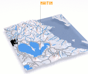 Places with similar names to Maitim, Philippines ::
Disclaimer :: Information on this page comes without warranty of any kind |
||
|
Where is Maitim? Elevation and coordinates ::
Latitude (lat): 14°10'44"N Longitude (lon): 121°16'37"E
Elevation (approx.): 11m (map arrows pan, magnifying glasses zoom) |
||
|
Visiting Maitim? Hotel/Accommodation ::
Book a hotel in Maitim Travel Guide ::
Buy a travel guide for Philippines rental cars ::
car rental offers GPS waypoint ::
download a GPX waypoint (PoI) of Maitim for your GPS receiver
|
||