|
search place name
|
||
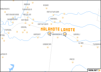
Malamote (North Cotabato, Philippines)Malamote is a town in the North Cotabato region of Philippines. An overview map of the region around Malamote is displayed below.
regional and 3d topo map of Malamote, Philippines ::
Malamote airports ::
The nearest airport is CEB - Cebu Cotabato, located 76.2 km west of Malamote.
Other airports nearby include CGY - Ladag Cagayan De Oro (151.9 km north), LGP - Legazpi Pagadian (179.1 km north west), Nearby towns ::
Matalam (1.6km north east) //
Manaboan (2.7km east) //
Katidtuan (4.2km north west) //
Kabacan (4.3km south) //
Mateo (4.5km north) //
Wangay (4.8km west) //
Marbel (5.5km north) //
Malamote (5.5km east) //
Paatan (6.6km north east) //
Natutungan (7.9km north) //
Paalan (8.2km north east) //
Sayugan (8.2km north west) //
Bulol (8.8km west) //
Aringay (8.9km north west) //
Kabacan (8.9km north west) //
Datu Mantauil (9.8km north east) //
Kilabeg (10.9km north west) //
Lamayong (10.9km north west) //
Kibudtungan (10.9km north west) //
Banawa (10.9km north west) //
Simone (10.9km north west) //
Tacolen (10.9km north west) //
Mateo (10.9km north west) //
Bual (10.9km north west) //
Bangilan (10.9km north west) //
Malapag (10.9km north west) //
Masalinan (10.9km north west) //
Pidtulusan (12.2km north west) //
Sampen (12.2km north west) //
[all distances 'as the bird flies' and approximate]  Places with similar names to Malamote, Philippines ::
// Melmad (MA)
// Malumot (PH)
// Mollaahmet (TR)
// Mollaahmet (TR)
// Mbulamuti (UG)
// Mbulamuti (UG)
// Mayloumoud (NE)
// Milmeidi (SD)
// Mulamata (ZM)
// Mollā Aḩmad (IR)
Disclaimer :: Information on this page comes without warranty of any kind |
||
|
Where is Malamote? Elevation and coordinates ::
Latitude (lat): 7°4'16"N Longitude (lon): 124°53'35"E
Elevation (approx.): 32m (map arrows pan, magnifying glasses zoom) |
||
|
Visiting Malamote? Hotel/Accommodation ::
Book a hotel in Malamote Travel Guide ::
Buy a travel guide for Philippines rental cars ::
car rental offers GPS waypoint ::
download a GPX waypoint (PoI) of Malamote for your GPS receiver
|
||