|
search place name
|
||
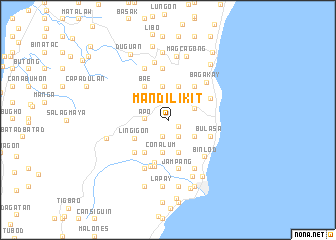
Mandilikit (Cebu, Philippines)Mandilikit is a town in the Cebu region of Philippines. An overview map of the region around Mandilikit is displayed below.
regional and 3d topo map of Mandilikit, Philippines ::
Mandilikit airports ::
The nearest airport is NOP - Masbate Mactan Cebu Intl, located 59.6 km north east of Mandilikit.
Other airports nearby include DGT - Dumaguete (74.3 km south west), BCD - Bacolod (104.2 km north west), ILO - Iloilo (140.8 km north west), SJI - San Jose Antique (201.0 km north west), Nearby towns ::
Sua (1.3km south east) //
Colawin (1.9km south) //
Langub (2.1km south east) //
Capio-an (2.1km south east) //
Loksoon (2.5km west) //
Apo (2.5km west) //
Montpeller (2.5km west) //
Cadalaputan (3.0km north east) //
Taloot (3.1km north east) //
Kabolijan (3.2km north west) //
Sumaguan (3.4km south east) //
Kadaatan (3.6km north east) //
Ubaub (3.7km south) //
Conalum (3.7km south) //
Mabasa (3.8km south) //
Tabon (3.9km north) //
Tubod (4.0km north) //
Lingigon (4.1km south west) //
Cansuje (4.4km south west) //
Kantolaroy (4.6km north west) //
Bae (4.6km north west) //
Lindogon (4.8km north east) //
Usmad (5.0km south) //
Bulasa (4.9km east) //
Alambihud (5.1km south west) //
Simala (5.3km north east) //
Panadtaran (5.4km south) //
Katang (5.5km south) //
Jampang (5.6km south) //
[all distances 'as the bird flies' and approximate]  Places with similar names to Mandilikit, Philippines ::
// Mount Lookout (US)
// Mandalgāti (BD)
// Mandalgāti (BD)
// Mandalakuda (LK)
// Mount Lookout (US)
// Mont-la-Côte (FR)
Disclaimer :: Information on this page comes without warranty of any kind |
||
|
Where is Mandilikit? Elevation and coordinates ::
Latitude (lat): 9°56'56"N Longitude (lon): 123°34'23"E
Elevation (approx.): 181m (map arrows pan, magnifying glasses zoom) |
||
|
Visiting Mandilikit? Hotel/Accommodation ::
Book a hotel in Mandilikit Travel Guide ::
Buy a travel guide for Philippines rental cars ::
car rental offers GPS waypoint ::
download a GPX waypoint (PoI) of Mandilikit for your GPS receiver
|
||