|
search place name
|
||
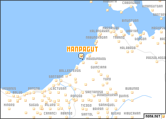
Manpagut (Leyte, Philippines)Manpagut is a town in the Leyte region of Philippines. An overview map of the region around Manpagut is displayed below.
regional and 3d topo map of Manpagut, Philippines ::
Manpagut airports ::
The nearest airport is TAC - Tacloban Daniel Z Romualdez, located 30.8 km south east of Manpagut.
Other airports nearby include NOP - Masbate Mactan Cebu Intl (146.5 km south west), BCD - Bacolod (217.8 km west), Nearby towns ::
Balud (0.8km south) //
Duka (1.7km north east) //
Minuhang (2.3km south west) //
Mawodpawod (2.9km east) //
Santa Cruz (3.4km north east) //
Tulaan (4.0km north east) //
Guinciana (4.4km south east) //
Ballesteros (4.5km south west) //
Bakong (4.6km north east) //
Balud (4.7km south) //
Caboloan (5.0km south east) //
Nabungkagan (5.1km north east) //
Cansagaya (5.2km south west) //
Tigbao (5.3km south) //
Impo (5.3km south east) //
Pamonacan (5.7km south) //
Nasonongan (6.4km south west) //
Kalangawan (6.6km north east) //
Malaihao (6.6km south east) //
Calingcaguing (6.9km south) //
Barugo (6.8km south west) //
Kabatong (6.9km north east) //
Ibag (7.2km south east) //
Roosevelt (7.4km south) //
Yuro (7.5km south east) //
Santarin (7.6km south west) //
Buquid (7.8km south west) //
Busay (7.8km south west) //
Pitogo (7.8km south west) //
[all distances 'as the bird flies' and approximate] 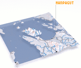 Places with similar names to Manpagut, Philippines ::
// Mān Hpaktu (MM)
// Minipogoda (LK)
Disclaimer :: Information on this page comes without warranty of any kind |
||
|
Where is Manpagut? Elevation and coordinates ::
Latitude (lat): 11°22'0"N Longitude (lon): 124°47'0"E
Elevation (approx.): 12m (map arrows pan, magnifying glasses zoom) |
||
|
Visiting Manpagut? Hotel/Accommodation ::
Book a hotel in Manpagut Travel Guide ::
Buy a travel guide for Philippines rental cars ::
car rental offers GPS waypoint ::
download a GPX waypoint (PoI) of Manpagut for your GPS receiver
|
||