|
search place name
|
||
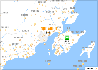
Mansawa (Cebu, Philippines)Mansawa is a town in the Cebu region of Philippines. An overview map of the region around Mansawa is displayed below.
regional and 3d topo map of Mansawa, Philippines ::
Mansawa airports ::
The nearest airport is NOP - Masbate Mactan Cebu Intl, located 6.9 km east of Mansawa.
Other airports nearby include BCD - Bacolod (113.9 km west), DGT - Dumaguete (128.0 km south west), ILO - Iloilo (156.4 km west), TAC - Tacloban Daniel Z Romualdez (157.9 km north east), Nearby towns ::
Taptap (0.0km north) //
Tayong (0.0km north) //
Paril (0.0km north) //
Maumawan (0.0km north) //
Tanay (0.0km north) //
Pangyao (0.0km north) //
Kanduman (0.0km north) //
Lusaran (0.0km north) //
Langob-Sirao (0.0km north) //
Maaslom-Lahug (0.0km north) //
Pasilagon (0.0km north) //
Kapangi-an (0.0km north) //
Pong-ol (0.0km north) //
Mahiga (0.0km north) //
Manggabon (0.0km north) //
Kandarong (0.0km north) //
Dita (0.0km north) //
Kamputhaw (0.0km north) //
Kambio-os (0.0km north) //
Kambitas-Balabag (0.0km north) //
Guba (0.0km north) //
Hoyonghoyong (0.0km north) //
Carreta (0.0km north) //
Hagnum (0.0km north) //
Baugo (0.0km north) //
Kambilog (0.0km north) //
Kambinokot (0.0km north) //
Tupas (0.0km north) //
Tonggo (0.0km north) //
[all distances 'as the bird flies' and approximate]  Places with similar names to Mansawa, Philippines ::
Disclaimer :: Information on this page comes without warranty of any kind |
||
|
Where is Mansawa? Elevation and coordinates ::
Latitude (lat): 10°19'0"N Longitude (lon): 123°55'0"E
Elevation (approx.): 8m (map arrows pan, magnifying glasses zoom) |
||
|
Visiting Mansawa? Hotel/Accommodation ::
Book a hotel in Mansawa Travel Guide ::
Buy a travel guide for Philippines rental cars ::
car rental offers GPS waypoint ::
download a GPX waypoint (PoI) of Mansawa for your GPS receiver
|
||