|
search place name
|
||
Mapalad (Tarlac, Philippines)Mapalad is a town in the Tarlac region of Philippines. An overview map of the region around Mapalad is displayed below.
regional and 3d topo map of Mapalad, Philippines ::

Mapalad airports ::
The nearest airport is BAG - Baguio, located 97.7 km north of Mapalad.
Other airports nearby include MNL - Manila Ninoy Aquino Intl (114.4 km south), Nearby towns ::
Lomboy (1.5km east) //
Batang-Batang (2.0km north west) //
Guevara (2.1km south east) //
Balingcanaway (2.4km south west) //
Matayumtayum (2.5km north) //
Bundoc (2.6km south east) //
Amucao (3.8km south west) //
Palacpalac (3.9km north) //
Macalong (4.0km south east) //
San Pascual (3.9km west) //
San Manuel (4.0km west) //
Lara (4.4km south) //
Laung Cupang (4.6km south) //
Cutcut (5.0km south west) //
Asturias (5.4km south west) //
Caramutan (5.7km south) //
Balayang (6.0km north) //
Mait (6.1km south east) //
Trinidad (6.1km west) //
La Paz (6.6km south east) //
San Jacinto (6.6km north west) //
Bantog (6.5km south west) //
Dumarais (6.9km south) //
Anupul (7.0km south) //
Libtong (7.7km south east) //
Caut (7.7km south east) //
San Jose (7.5km west) //
Santa Barbara (7.9km north) //
Sierra (8.0km south) //
[all distances 'as the bird flies' and approximate] 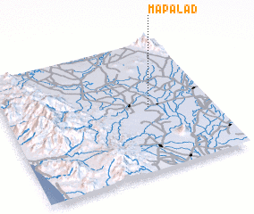 Places with similar names to Mapalad, Philippines ::
Disclaimer :: Information on this page comes without warranty of any kind |
||
|
Where is Mapalad? Elevation and coordinates ::
Latitude (lat): 15°29'45"N Longitude (lon): 120°42'8"E
Elevation (approx.): 25m (map arrows pan, magnifying glasses zoom) |
||
|
Visiting Mapalad? Hotel/Accommodation ::
Book a hotel in Mapalad Travel Guide ::
Buy a travel guide for Philippines rental cars ::
car rental offers GPS waypoint ::
download a GPX waypoint (PoI) of Mapalad for your GPS receiver
|
||