|
search place name
|
||
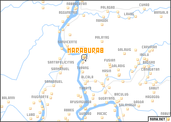
Maraburab (Cagayan, Philippines)Maraburab is a town in the Cagayan region of Philippines. An overview map of the region around Maraburab is displayed below.
regional and 3d topo map of Maraburab, Philippines ::
Maraburab airports ::
The nearest airport is BAG - Baguio, located 205.5 km south west of Maraburab.
Nearby towns ::
Caral-langan (0.6km south west) //
Tallu (2.1km north) //
Tupang (2.4km south) //
Piggatan (2.8km north east) //
Nassaping (3.4km north west) //
Dungao (3.8km north west) //
Alcala (4.4km south) //
Caccag (4.3km north west) //
Baculud (4.9km south east) //
Baquilao (5.0km south) //
San Vicente (5.0km north west) //
Fusian (5.1km east) //
Santa Felicitas (5.3km west) //
Masin (5.4km south east) //
Palayag (5.5km north east) //
Bulbulala (5.4km east) //
Abarriongan (5.4km west) //
Balagan (5.6km north west) //
San Manuel (5.8km south west) //
Paret (6.1km south east) //
Pinopoc (6.1km south east) //
Aggunatan (6.6km north west) //
Pagbangacanaoan (6.6km south east) //
Tabayo (6.9km south) //
Dalaoig (7.1km east) //
Nantatapian (7.6km south) //
Tamban (7.7km south) //
Baybayog (7.6km south east) //
Malalatan (7.9km south) //
[all distances 'as the bird flies' and approximate]  Places with similar names to Maraburab, Philippines :: Disclaimer :: Information on this page comes without warranty of any kind |
||
|
Where is Maraburab? Elevation and coordinates ::
Latitude (lat): 17°56'42"N Longitude (lon): 121°39'3"E
Elevation (approx.): 15m (map arrows pan, magnifying glasses zoom) |
||
|
Visiting Maraburab? Hotel/Accommodation ::
Book a hotel in Maraburab Travel Guide ::
Buy a travel guide for Philippines rental cars ::
car rental offers GPS waypoint ::
download a GPX waypoint (PoI) of Maraburab for your GPS receiver
|
||