|
search place name
|
||
Mauraro (Albay, Philippines)Mauraro is a town in the Albay region of Philippines. An overview map of the region around Mauraro is displayed below.
regional and 3d topo map of Mauraro, Philippines ::

Mauraro airports ::
The nearest airport is KLO - Kalibo, located 210.0 km south west of Mauraro.
Other airports nearby include TAC - Tacloban Daniel Z Romualdez (263.7 km south east), Nearby towns ::
Managay (0.4km east) //
Tagoytoy (1.4km west) //
Cagan (1.4km west) //
Kitago (1.8km north) //
Miti (2.0km south) //
Iluluan (2.0km south) //
Palanog (2.2km east) //
Bamban (2.2km north west) //
Palanog (2.2km east) //
Camalia (2.2km east) //
Guibacag (2.4km south west) //
Mataguisi (2.4km south west) //
Tubigan (3.6km north west) //
Comun (3.6km north west) //
Malobago (3.8km south west) //
Camagong (3.9km south) //
Bariw (3.8km east) //
Malabning (3.8km north) //
Cabanog (3.8km north) //
Guinobatan (4.2km north) //
Caguiba (4.4km south east) //
Tulatula (4.5km south east) //
Pariaan (4.7km south) //
Halazaan (4.8km north west) //
Tagaytay (4.8km east) //
Naminuet (5.0km south west) //
Naologan (5.0km south west) //
Baligang (5.0km east) //
Malipo (5.3km south west) //
[all distances 'as the bird flies' and approximate] 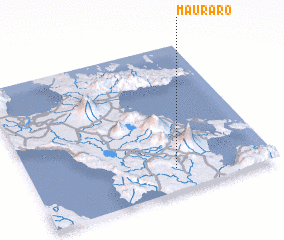 Places with similar names to Mauraro, Philippines ::
Disclaimer :: Information on this page comes without warranty of any kind |
||
|
Where is Mauraro? Elevation and coordinates ::
Latitude (lat): 13°9'4"N Longitude (lon): 123°35'46"E
Elevation (approx.): 153m (map arrows pan, magnifying glasses zoom) |
||
|
Visiting Mauraro? Hotel/Accommodation ::
Book a hotel in Mauraro Travel Guide ::
Buy a travel guide for Philippines rental cars ::
car rental offers GPS waypoint ::
download a GPX waypoint (PoI) of Mauraro for your GPS receiver
|
||