|
search place name
|
||
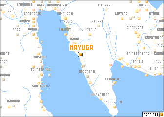
Mayuga (Southern Leyte, Philippines)Mayuga is a town in the Southern Leyte region of Philippines. An overview map of the region around Mayuga is displayed below.
regional and 3d topo map of Mayuga, Philippines ::
Mayuga airports ::
The nearest airport is TAC - Tacloban Daniel Z Romualdez, located 104.5 km north of Mayuga.
Other airports nearby include NOP - Masbate Mactan Cebu Intl (119.1 km west), CGY - Ladag Cagayan De Oro (212.5 km south), DGT - Dumaguete (220.4 km south west), Nearby towns ::
Kawayan (0.5km south west) //
Labao (1.8km south) //
Punta (1.9km south) //
Libagon (2.3km north west) //
Jubas (2.6km north west) //
Tigbao (3.8km north west) //
Magcasag (4.2km south) //
Oticon (5.7km north west) //
Limasawa (5.9km north) //
Magopas (5.9km south) //
Maibog (5.9km south) //
Talisay (6.6km north west) //
Himbangan (6.6km east) //
Nahulid (8.0km north west) //
Atuyan (8.3km north east) //
San Isidro (8.2km south west) //
Himatagon (8.4km east) //
Lepanto (9.1km south east) //
Hindag-an (9.2km south east) //
[all distances 'as the bird flies' and approximate]  Places with similar names to Mayuga, Philippines ::
// Mayeik (MM)
// Mi-yuk (MM)
// Mayak (AZ)
// Myeik (MM)
// Mouyouka I (CM)
// Mouyouka II (CM)
// Muyuka (CM)
// Muyuka (CM)
// Moyog (MY)
// Moyog (MY)
Disclaimer :: Information on this page comes without warranty of any kind |
||
|
Where is Mayuga? Elevation and coordinates ::
Latitude (lat): 10°17'0"N Longitude (lon): 125°4'0"E
Elevation (approx.): 197m (map arrows pan, magnifying glasses zoom) |
||
|
Visiting Mayuga? Hotel/Accommodation ::
Book a hotel in Mayuga Travel Guide ::
Buy a travel guide for Philippines rental cars ::
car rental offers GPS waypoint ::
download a GPX waypoint (PoI) of Mayuga for your GPS receiver
|
||