|
search place name
|
||
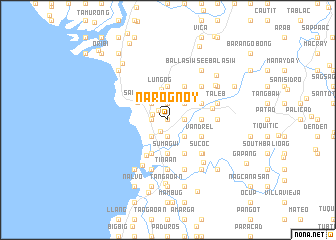
Narognoy (Ilocos Sur, Philippines)Narognoy is a town in the Ilocos Sur region of Philippines. An overview map of the region around Narognoy is displayed below.
regional and 3d topo map of Narognoy, Philippines ::
Narognoy airports ::
The nearest airport is BAG - Baguio, located 118.0 km south of Narognoy.
Nearby towns ::
Dinalaoan (0.0km north) //
Quimmara (1.5km north west) //
Narvacan (1.5km south west) //
Margaay (1.7km west) //
Margaay (1.8km west) //
Pantoc (1.9km south) //
Casilagan (1.9km south) //
Rivadavia (1.9km south) //
Abuor (1.9km south) //
Cadacad (1.9km south) //
Aquib (1.9km north) //
Orence (1.8km east) //
Ambulogan (2.4km north) //
Paratong (2.6km south west) //
San Pablo (2.6km south west) //
Lanipao (2.6km south west) //
San Antonio (2.6km south west) //
Quinarayan (2.6km north west) //
Dasay (2.6km south east) //
Parparia (2.6km north east) //
Lungog (3.5km north) //
Sumagui (3.7km south) //
Ambulogan-Labuac (3.7km north) //
Mission (3.5km east) //
Salvec (3.8km north west) //
Nanguneg (4.1km south west) //
Cagayungan (4.1km south east) //
Vandrel (4.0km south east) //
Banglayan (4.1km north east) //
[all distances 'as the bird flies' and approximate]  Places with similar names to Narognoy, Philippines ::
// Nǝrǝcan (AZ)
// Narigan (MM)
// Narganá (PA)
// Narkūnai (LT)
// Narkūnai (LT)
// Narkūnai (LT)
// Narkūnai I (LT)
// Narkūnai II (LT)
// Nereikoniai (LT)
// Noreikoniai (LT)
Disclaimer :: Information on this page comes without warranty of any kind |
||
|
Where is Narognoy? Elevation and coordinates ::
Latitude (lat): 17°26'0"N Longitude (lon): 120°29'0"E
Elevation (approx.): 7m (map arrows pan, magnifying glasses zoom) |
||
|
Visiting Narognoy? Hotel/Accommodation ::
Book a hotel in Narognoy Travel Guide ::
Buy a travel guide for Philippines rental cars ::
car rental offers GPS waypoint ::
download a GPX waypoint (PoI) of Narognoy for your GPS receiver
|
||