|
search place name
|
||
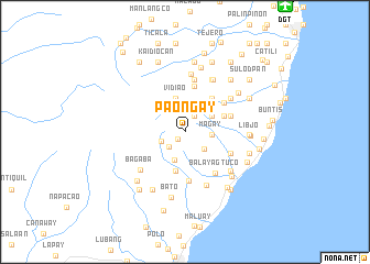
Paongay (Negros Oriental, Philippines)Paongay is a town in the Negros Oriental region of Philippines. An overview map of the region around Paongay is displayed below.
regional and 3d topo map of Paongay, Philippines ::
Paongay airports ::
The nearest airport is DGT - Dumaguete, located 16.2 km north east of Paongay.
Other airports nearby include NOP - Masbate Mactan Cebu Intl (147.1 km north east), LGP - Legazpi Pagadian (156.4 km south), BCD - Bacolod (160.4 km north), CGY - Ladag Cagayan De Oro (178.1 km south east), Nearby towns ::
Baslay (1.0km south west) //
Bolocboloc (1.8km north east) //
Marait (2.2km south west) //
Tagontong (2.5km west) //
Bayang (2.6km south east) //
Magay (2.8km east) //
Jamaoas (3.0km south) //
Tagbac (3.2km north east) //
Vidiao (3.5km north) //
Kalayongan (4.1km south) //
Malongcay Diutay (4.1km south) //
Buntod (4.2km north east) //
Calungan (4.4km north east) //
Mangalag (4.4km north east) //
Inas (4.8km north) //
Magaso (4.8km east) //
Doldol (4.8km east) //
Timbao (4.9km north east) //
Malongcaydacu (5.0km south) //
Panubtuban (5.0km south east) //
Balayagtuco (5.2km south east) //
Lunga (5.4km north) //
Timbañga (5.7km north east) //
Magsuhot (5.7km north east) //
Nabago (5.9km south) //
Cabosio (5.9km north) //
Bagaba (5.9km south west) //
Jawa (6.0km north east) //
Mampas (6.0km north east) //
[all distances 'as the bird flies' and approximate] 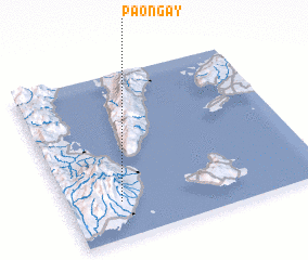 Places with similar names to Paongay, Philippines ::
Disclaimer :: Information on this page comes without warranty of any kind |
||
|
Where is Paongay? Elevation and coordinates ::
Latitude (lat): 9°13'9"N Longitude (lon): 123°12'30"E
Elevation (approx.): 571m (map arrows pan, magnifying glasses zoom) |
||
|
Visiting Paongay? Hotel/Accommodation ::
Book a hotel in Paongay Travel Guide ::
Buy a travel guide for Philippines rental cars ::
car rental offers GPS waypoint ::
download a GPX waypoint (PoI) of Paongay for your GPS receiver
|
||