|
search place name
|
||
Pawa (Legaspi, Philippines)Pawa is a town in the Legaspi region of Philippines. An overview map of the region around Pawa is displayed below.
regional and 3d topo map of Pawa, Philippines ::

Pawa airports ::
The nearest airport is KLO - Kalibo, located 221.6 km south west of Pawa.
Other airports nearby include TAC - Tacloban Daniel Z Romualdez (257.4 km south east), Nearby towns ::
Borabod (0.9km south) //
Bogtong (0.9km south) //
Gogon (1.3km south) //
Bogña (1.9km north) //
Tagas (2.0km south west) //
Acala (2.0km south west) //
Rawis (2.2km east) //
Kilicao (2.4km west) //
Sagpon (2.7km south) //
Bonot (2.7km south) //
Matanag (2.8km north) //
Buyuhan (2.9km north) //
Arimbay (3.1km north east) //
San Roque (3.2km south east) //
Talaib (3.3km south west) //
Mabini (3.3km south west) //
Ibaogan (3.3km south west) //
Bantog (3.3km south west) //
Budiao (3.3km south west) //
Kidaco (3.3km south west) //
Bogñalon (3.3km south west) //
Kiwalo (3.3km south west) //
Bactol (3.3km south west) //
Nabasan (3.3km south west) //
Culliat (3.3km south west) //
Bincagao (3.3km south west) //
Burgos (3.3km south west) //
Alcala (3.3km south west) //
Bigao (3.3km south west) //
[all distances 'as the bird flies' and approximate] 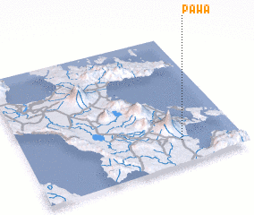 Places with similar names to Pawa, Philippines ::
Disclaimer :: Information on this page comes without warranty of any kind |
||
|
Where is Pawa? Elevation and coordinates ::
Latitude (lat): 13°10'29"N Longitude (lon): 123°43'58"E
Elevation (approx.): 36m (map arrows pan, magnifying glasses zoom) |
||
|
Visiting Pawa? Hotel/Accommodation ::
Book a hotel in Pawa Travel Guide ::
Buy a travel guide for Philippines rental cars ::
car rental offers GPS waypoint ::
download a GPX waypoint (PoI) of Pawa for your GPS receiver
|
||