|
search place name
|
||
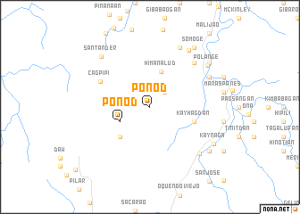
Ponod (Northern Samar, Philippines)Ponod is a town in the Northern Samar region of Philippines. An overview map of the region around Ponod is displayed below.
regional and 3d topo map of Ponod, Philippines ::
Ponod airports ::
The nearest airport is TAC - Tacloban Daniel Z Romualdez, located 133.9 km south of Ponod.
Other airports nearby include BCD - Bacolod (259.9 km south west), Nearby towns ::
Kagbunga (2.6km north east) //
Ponod (4.1km south west) //
Himanalud (4.6km north) //
Macatiñgog (5.2km south west) //
Kayhagdan (5.7km east) //
Cagpipi (6.8km north west) //
Paticua (7.8km north east) //
Sandinogan (8.1km north east) //
Pagsangan (8.1km north east) //
Colarema (8.3km north east) //
Lope de Vega (8.5km south east) //
Kagabaca (8.6km north east) //
Santander (8.7km north west) //
Polañge (8.7km north east) //
Kaynaga (9.1km south east) //
Ngawo (9.1km south east) //
Manalibong (9.1km north east) //
Somoge (9.2km north east) //
[all distances 'as the bird flies' and approximate] 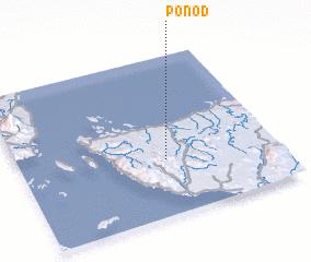 Places with similar names to Ponod, Philippines ::
Disclaimer :: Information on this page comes without warranty of any kind |
||
|
Where is Ponod? Elevation and coordinates ::
Latitude (lat): 12°21'0"N Longitude (lon): 124°34'0"E
Elevation (approx.): 186m (map arrows pan, magnifying glasses zoom) |
||
|
Visiting Ponod? Hotel/Accommodation ::
Book a hotel in Ponod Travel Guide ::
Buy a travel guide for Philippines rental cars ::
car rental offers GPS waypoint ::
download a GPX waypoint (PoI) of Ponod for your GPS receiver
|
||