|
search place name
|
||
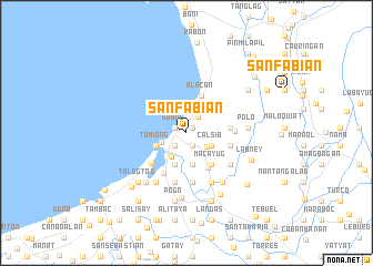
San Fabian (Pangasinan, Philippines)San Fabian is a town in the Pangasinan region of Philippines. An overview map of the region around San Fabian is displayed below.
regional and 3d topo map of San Fabian, Philippines ::
San Fabian airports ::
The nearest airport is BAG - Baguio, located 35.3 km north east of San Fabian.
Other airports nearby include MNL - Manila Ninoy Aquino Intl (190.8 km south), Nearby towns ::
Tococ (0.8km north east) //
Sobol (1.3km north west) //
Sagud Baley (1.3km north west) //
Monang (1.4km south east) //
Lequep (1.4km south east) //
Amansic (1.4km south east) //
Buetao (1.7km south west) //
Cayanga (1.7km south west) //
Tempra (2.0km north east) //
Angio (2.4km south east) //
Nibalio (2.5km west) //
Anonang (2.7km south east) //
Calsib (2.7km south east) //
Longos (2.8km south west) //
Mabilao (2.9km north east) //
Cayañga (3.2km south) //
Loñgos (3.2km south west) //
Tamiong (3.2km south west) //
Inlambo (3.4km south) //
Amanoaoac (3.4km north east) //
Palapad (3.6km north east) //
Cabaruan (4.0km south east) //
Makiog (4.0km south east) //
Macayug (4.0km south east) //
Alacan (4.0km north) //
Macayug (4.1km south east) //
Baraoas (4.2km east) //
Baragas (4.4km east) //
Bantayan (4.6km south west) //
[all distances 'as the bird flies' and approximate] 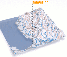 Places with similar names to San Fabian, Philippines ::
Disclaimer :: Information on this page comes without warranty of any kind |
||
|
Where is San Fabian? Elevation and coordinates ::
Latitude (lat): 16°7'42"N Longitude (lon): 120°24'39"E
Elevation (approx.): 6m (map arrows pan, magnifying glasses zoom) |
||
|
Visiting San Fabian? Hotel/Accommodation ::
Book a hotel in San Fabian Travel Guide ::
Buy a travel guide for Philippines rental cars ::
car rental offers GPS waypoint ::
download a GPX waypoint (PoI) of San Fabian for your GPS receiver
|
||