|
search place name
|
||
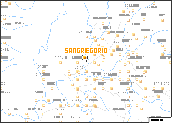
San Gregorio (Abra, Philippines)San Gregorio is a town in the Abra region of Philippines. An overview map of the region around San Gregorio is displayed below.
regional and 3d topo map of San Gregorio, Philippines ::
San Gregorio airports ::
The nearest airport is BAG - Baguio, located 141.4 km south of San Gregorio.
Nearby towns ::
Sagap (1.8km west) //
Liguis (1.8km west) //
Bengen (1.8km east) //
Nagpanaoan (2.2km south) //
Sapday (2.3km north east) //
Fomodoc (2.8km south west) //
Bulabula (2.7km east) //
Muding (2.8km south west) //
Isit (3.5km east) //
Pangal (3.5km east) //
Pidipid (3.6km north east) //
Bangbañgar (4.0km south) //
Padangitan (3.9km north east) //
Canan (3.8km east) //
Bañacao (4.1km south west) //
Tayum (4.4km south east) //
Calaba (4.4km south west) //
Lingtan (4.4km south east) //
Caupasan (4.4km north east) //
San Antonio (4.5km south west) //
Domigiay (4.6km north east) //
Damulog (5.0km north east) //
Namilagan (5.3km north) //
Deet (5.3km south east) //
Galao (5.5km north) //
Cabaroan (5.5km north) //
Danglas (5.5km north) //
Maipalig (5.3km west) //
Patucannay (5.7km south) //
[all distances 'as the bird flies' and approximate] 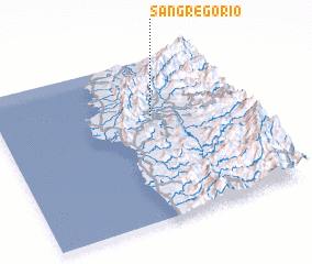 Places with similar names to San Gregorio, Philippines ::
// San Gregorio (US)
// San Gregorio (IT)
// San Gregorio (IT)
// San Gregorio (IT)
// San Gregorio (IT)
// San Gregorio (IT)
// San Gregorio (IT)
// San Gregorio (IT)
// San Gregorio (CU)
// San Gregorio (CU)
Disclaimer :: Information on this page comes without warranty of any kind |
||
|
Where is San Gregorio? Elevation and coordinates ::
Latitude (lat): 17°39'10"N Longitude (lon): 120°38'0"E
Elevation (approx.): 53m (map arrows pan, magnifying glasses zoom) |
||
|
Visiting San Gregorio? Hotel/Accommodation ::
Book a hotel in San Gregorio Travel Guide ::
Buy a travel guide for Philippines rental cars ::
car rental offers GPS waypoint ::
download a GPX waypoint (PoI) of San Gregorio for your GPS receiver
|
||