|
search place name
|
||
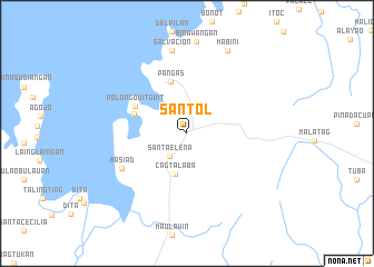
Santol (Camarines Norte, Philippines)Santol is a town in the Camarines Norte region of Philippines. An overview map of the region around Santol is displayed below.
regional and 3d topo map of Santol, Philippines ::
Santol airports ::
The nearest airport is MNL - Manila Ninoy Aquino Intl, located 152.6 km west of Santol.
Nearby towns ::
Santa Elena (2.8km south west) //
Betongal (3.1km north west) //
Cagtalaba (4.3km south) //
Pangas (5.4km north) //
Balikiao (5.5km west) //
Polongguit-guit (5.8km north west) //
Basiad (7.2km south west) //
Salvacion (8.4km north) //
Mabini (9.2km north east) //
[all distances 'as the bird flies' and approximate] 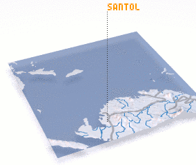 Places with similar names to Santol, Philippines ::
Disclaimer :: Information on this page comes without warranty of any kind |
||
|
Where is Santol? Elevation and coordinates ::
Latitude (lat): 14°11'31"N Longitude (lon): 122°23'49"E
Elevation (approx.): 10m (map arrows pan, magnifying glasses zoom) |
||
|
Visiting Santol? Hotel/Accommodation ::
Book a hotel in Santol Travel Guide ::
Buy a travel guide for Philippines rental cars ::
car rental offers GPS waypoint ::
download a GPX waypoint (PoI) of Santol for your GPS receiver
|
||