|
search place name
|
||
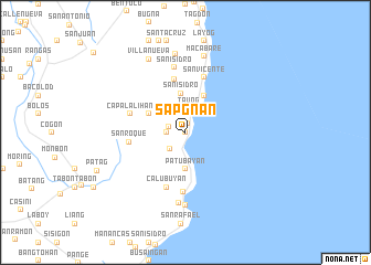
Sapgnan (Sorsogon, Philippines)Sapgnan is a town in the Sorsogon region of Philippines. An overview map of the region around Sapgnan is displayed below.
regional and 3d topo map of Sapgnan, Philippines ::
Sapgnan airports ::
The nearest airport is TAC - Tacloban Daniel Z Romualdez, located 194.5 km south east of Sapgnan.
Other airports nearby include KLO - Kalibo (224.9 km south west), Nearby towns ::
Cobugauan (0.0km north) //
Dolipay (0.0km north) //
Bulusan (0.9km north) //
San Francisco (1.7km west) //
Layo (1.8km west) //
San José (1.9km north) //
Dancalan (1.9km north) //
San Bernardo (2.3km south west) //
Tauog (2.5km north) //
Tawog (2.5km north) //
Copayagitan (2.6km north west) //
Patubayan (3.7km south) //
San Isidro (4.0km north) //
Bunan (4.1km north east) //
Bariw (4.1km north west) //
Ilihan (4.1km north west) //
Santa Barbara (5.5km north) //
San Roque (5.7km west) //
Calubuyan (5.8km south) //
Capalalihan (5.7km west) //
San Vicente (5.8km north) //
San Antonio (6.0km south) //
San Isidro (6.6km north) //
Talaonga (7.2km south) //
San Antonio (7.4km south) //
San Bartolome (7.4km south) //
Macabare (7.9km north) //
Paghaluban (7.9km north) //
Villanueva (8.2km north west) //
[all distances 'as the bird flies' and approximate]  Places with similar names to Sapgnan, Philippines ::
Disclaimer :: Information on this page comes without warranty of any kind |
||
|
Where is Sapgnan? Elevation and coordinates ::
Latitude (lat): 12°45'0"N Longitude (lon): 124°8'0"E
Elevation (approx.): 23m (map arrows pan, magnifying glasses zoom) |
||
|
Visiting Sapgnan? Hotel/Accommodation ::
Book a hotel in Sapgnan Travel Guide ::
Buy a travel guide for Philippines rental cars ::
car rental offers GPS waypoint ::
download a GPX waypoint (PoI) of Sapgnan for your GPS receiver
|
||