|
search place name
|
||
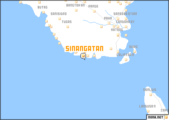
Sinangatan (Sorsogon, Philippines)Sinangatan is a town in the Sorsogon region of Philippines. An overview map of the region around Sinangatan is displayed below.
regional and 3d topo map of Sinangatan, Philippines ::
Sinangatan airports ::
The nearest airport is TAC - Tacloban Daniel Z Romualdez, located 181.7 km south east of Sinangatan.
Other airports nearby include KLO - Kalibo (202.0 km south west), BCD - Bacolod (240.4 km south west), ILO - Iloilo (257.5 km south west), Nearby towns ::
Mambajog (1.1km north east) //
Manorabe (1.9km north) //
Ginablan (2.3km north east) //
Suja (2.6km north west) //
Sua (2.6km north west) //
Coron-Coron (4.6km north west) //
Badiang (4.9km north west) //
Calasi (6.3km north east) //
Cobarawan (6.6km north west) //
San Jose (7.5km east) //
Lamaoan (7.5km east) //
Canomalas (7.7km north west) //
Mansibog (8.2km north east) //
Tugas (8.2km north west) //
Lipata (8.8km north west) //
Genablan (9.1km north east) //
Balocawe (9.1km north east) //
Matnog (9.2km north east) //
Pawa (9.8km north east) //
Calibag (9.9km north east) //
Culasi (10.4km north east) //
Manjumlad (10.4km north east) //
Quezon (10.4km north west) //
Marinab (10.9km north west) //
Biton (11.9km north west) //
[all distances 'as the bird flies' and approximate] 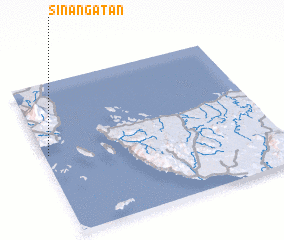 Places with similar names to Sinangatan, Philippines ::
// Sinnington (GB)
Disclaimer :: Information on this page comes without warranty of any kind |
||
|
Where is Sinangatan? Elevation and coordinates ::
Latitude (lat): 12°32'0"N Longitude (lon): 124°1'0"E
Elevation (approx.): -32768m (map arrows pan, magnifying glasses zoom) |
||
|
Visiting Sinangatan? Hotel/Accommodation ::
Book a hotel in Sinangatan Travel Guide ::
Buy a travel guide for Philippines rental cars ::
car rental offers GPS waypoint ::
download a GPX waypoint (PoI) of Sinangatan for your GPS receiver
|
||