|
search place name
|
||
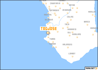
Tag Jose (Quezon, Philippines)Tag Jose is a town in the Quezon region of Philippines. An overview map of the region around Tag Jose is displayed below.
regional and 3d topo map of Tag Jose, Philippines ::
Tag Jose airports ::
The nearest airport is KLO - Kalibo, located 175.2 km south of Tag Jose.
Other airports nearby include MNL - Manila Ninoy Aquino Intl (213.2 km north west), Nearby towns ::
Casay (0.8km north) //
Kanmansad (0.9km south) //
Manioñgon (2.7km south) //
Tubog (3.1km south east) //
Nasalaan (3.1km south east) //
Auasan (3.3km north) //
Payo (3.3km north east) //
Kunoy (3.4km east) //
Canlambay (4.3km north) //
Siloñgin (4.7km north) //
Mahiram (4.8km south) //
Yabaan (4.8km south) //
Pagsañgahan (5.3km south east) //
Niyog (5.8km north east) //
Magarang (6.6km north) //
Navitas (6.6km north) //
Tala (7.5km north east) //
Kanagakook (7.7km north east) //
Sili (7.6km east) //
Luauan (8.0km north) //
Inabuan (8.5km north) //
Tumbayog (8.4km north east) //
Nataasan (8.5km north) //
Malangog (8.5km south east) //
Coling (10.0km north east) //
Inmangas (10.9km north east) //
[all distances 'as the bird flies' and approximate] 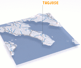 Places with similar names to Tag Jose, Philippines ::
// Dagujiazi (CN)
Disclaimer :: Information on this page comes without warranty of any kind |
||
|
Where is Tag Jose? Elevation and coordinates ::
Latitude (lat): 13°15'26"N Longitude (lon): 122°31'10"E
Elevation (approx.): 16m (map arrows pan, magnifying glasses zoom) |
||
|
Visiting Tag Jose? Hotel/Accommodation ::
Book a hotel in Tag Jose Travel Guide ::
Buy a travel guide for Philippines rental cars ::
car rental offers GPS waypoint ::
download a GPX waypoint (PoI) of Tag Jose for your GPS receiver
|
||