|
search place name
|
||
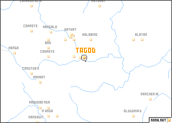
Tagod (Quirino, Philippines)Tagod is a town in the Quirino region of Philippines. An overview map of the region around Tagod is displayed below.
regional and 3d topo map of Tagod, Philippines ::
Tagod airports ::
The nearest airport is BAG - Baguio, located 76.1 km west of Tagod.
Other airports nearby include MNL - Manila Ninoy Aquino Intl (198.0 km south), Nearby towns ::
Tanap (1.5km north west) //
Siguem (2.7km north west) //
Malabing (4.9km north) //
Alloy (5.4km north west) //
Dilaping (6.2km north west) //
Talimpogo (6.2km north west) //
Kasibu (6.4km north west) //
Watwat (6.6km north west) //
Campote (7.9km west) //
Boa (8.4km west) //
Kongkong (9.2km north west) //
Mangalo (9.7km north west) //
[all distances 'as the bird flies' and approximate] 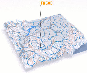 Places with similar names to Tagod, Philippines ::
Disclaimer :: Information on this page comes without warranty of any kind |
||
|
Where is Tagod? Elevation and coordinates ::
Latitude (lat): 16°16'26"N Longitude (lon): 121°19'25"E
Elevation (approx.): 678m (map arrows pan, magnifying glasses zoom) |
||
|
Visiting Tagod? Hotel/Accommodation ::
Book a hotel in Tagod Travel Guide ::
Buy a travel guide for Philippines rental cars ::
car rental offers GPS waypoint ::
download a GPX waypoint (PoI) of Tagod for your GPS receiver
|
||