|
search place name
|
||
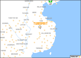
Tubo Pait (Zamboanga del Sur, Philippines)Tubo Pait is a town in the Zamboanga del Sur region of Philippines. An overview map of the region around Tubo Pait is displayed below.
regional and 3d topo map of Tubo Pait, Philippines ::
Tubo Pait airports ::
The nearest airport is LGP - Legazpi Pagadian, located 13.6 km north of Tubo Pait.
Other airports nearby include CEB - Cebu Cotabato (106.3 km south east), CGY - Ladag Cagayan De Oro (152.9 km north east), ZAM - Zamboanga Intl (173.4 km south west), DGT - Dumaguete (179.9 km north), Nearby towns ::
Mabulay (1.8km south) //
Saobulan (1.9km east) //
Mulansong (2.4km south) //
Tina (2.7km north) //
Payag (3.3km west) //
Sitio Luribong (3.5km south) //
Villa Kappa (4.1km south east) //
Pangapong (4.2km south) //
Bagong Misamis (4.1km east) //
Rebokon (4.7km north) //
Kondom (4.7km south) //
Mitokong (4.8km north east) //
Kapamanok (4.8km south) //
Cuatro Cuatro (5.0km north west) //
Bagong Silao (5.3km east) //
Senior (5.4km south east) //
Nupulan (5.5km north east) //
Mama (5.8km north east) //
San Augustin (5.9km north) //
Pao (6.0km south) //
Pantad (6.2km south east) //
Sunggoy (6.2km south west) //
Bibilik (6.2km north east) //
Culasian (6.3km east) //
Maasin (6.5km south) //
Litan (6.5km west) //
Tagalo (6.6km east) //
Guiniculalay (6.8km south west) //
Baga (7.0km north) //
[all distances 'as the bird flies' and approximate]  Places with similar names to Tubo Pait, Philippines :: Disclaimer :: Information on this page comes without warranty of any kind |
||
|
Where is Tubo Pait? Elevation and coordinates ::
Latitude (lat): 7°42'42"N Longitude (lon): 123°25'1"E
Elevation (approx.): 164m (map arrows pan, magnifying glasses zoom) |
||
|
Visiting Tubo Pait? Hotel/Accommodation ::
Book a hotel in Tubo Pait Travel Guide ::
Buy a travel guide for Philippines rental cars ::
car rental offers GPS waypoint ::
download a GPX waypoint (PoI) of Tubo Pait for your GPS receiver
|
||