|
search place name
|
||
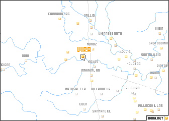
Vira (Isabela, Philippines)Vira is a town in the Isabela region of Philippines. An overview map of the region around Vira is displayed below.
regional and 3d topo map of Vira, Philippines ::
Vira airports ::
The nearest airport is BAG - Baguio, located 134.0 km south west of Vira.
Nearby towns ::
San Jose (1.9km north) //
Roxas (2.5km south east) //
Muñoz (3.0km north east) //
Namakalan (3.6km south east) //
Natorosuan (4.0km north west) //
Songsong (4.0km west) //
Lasedeco Numero Dos (4.8km south) //
San Jose Este (6.1km north) //
Casili (7.4km north) //
Quiling (7.3km east) //
Matusalela (7.6km south) //
Viernes Santo (7.5km north east) //
Ambito (7.4km north east) //
Villanueva (8.2km south east) //
San Jose Norte (8.3km north) //
Mallig (9.0km north) //
Sandiat (9.7km south east) //
[all distances 'as the bird flies' and approximate] 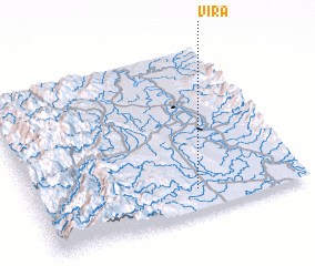 Places with similar names to Vira, Philippines ::
Disclaimer :: Information on this page comes without warranty of any kind |
||
|
Where is Vira? Elevation and coordinates ::
Latitude (lat): 17°8'0"N Longitude (lon): 121°36'0"E
Elevation (approx.): 59m (map arrows pan, magnifying glasses zoom) |
||
|
Visiting Vira? Hotel/Accommodation ::
Book a hotel in Vira Travel Guide ::
Buy a travel guide for Philippines rental cars ::
car rental offers GPS waypoint ::
download a GPX waypoint (PoI) of Vira for your GPS receiver
|
||