|
search place name
|
||
Asquith (New South Wales, Australia)Asquith is a town in the New South Wales region of Australia. An overview map of the region around Asquith is displayed below.
regional and 3d topo map of Asquith, Australia ::

Asquith airports ::
The nearest airport is BWU - Sydney Bankstown, located 28.7 km south of Asquith.
Other airports nearby include SYD - Sydney Intl (30.0 km south), RCM - Richmond (31.0 km west), CDU - Camden (55.0 km south west), CBR - Canberra (251.1 km south west), Nearby towns ::
Mount Colah (1.5km east) //
Hornsby (1.9km south) //
Waitara (4.0km south east) //
Wahroonga (4.0km south east) //
Normanhurst (5.6km south) //
Warrawee (5.8km south) //
Thornleigh (5.8km south) //
Galston (5.9km north west) //
Pennant Hills (6.4km south west) //
Turramurra (6.4km south east) //
North Turramurra (5.9km south east) //
Berrilee (7.4km north) //
Berowra (7.2km north east) //
Gordon (8.0km south east) //
Pymble (8.7km south east) //
Saint Ives (8.3km south east) //
Arcadia (9.6km north west) //
[all distances 'as the bird flies' and approximate] 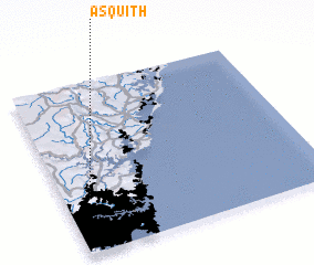
Disclaimer :: Information on this page comes without warranty of any kind |
||
|
Where is Asquith? Elevation and coordinates ::
Latitude (lat): 33°41'0"S Longitude (lon): 151°6'0"E
Elevation (approx.): 175m (map arrows pan, magnifying glasses zoom) |
||
|
Visiting Asquith? Hotel/Accommodation ::
Book a hotel in Asquith Travel Guide ::
Buy a travel guide for Australia rental cars ::
car rental offers GPS waypoint ::
download a GPX waypoint (PoI) of Asquith for your GPS receiver
|
||