|
search place name
|
||
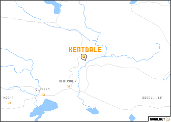
Kentdale (Western Australia, Australia)Kentdale is a town in the Western Australia region of Australia. An overview map of the region around Kentdale is displayed below.
regional and 3d topo map of Kentdale, Australia ::
Nearby towns ::
Kent River (6.3km south west) //
[all distances 'as the bird flies' and approximate]  Places with similar names to Kentdale, Australia ::
// Quinta do Leão (PT)
// Kintutila (CD)
// Condadillo (SV)
// Condadillo (SV)
// Gandital (PK)
// Kandu Dol (PK)
// Kund Utla (PK)
// Kund Utla (PK)
// Condadillo (HN)
// Kindadal (ID)
Disclaimer :: Information on this page comes without warranty of any kind |
||
|
Where is Kentdale? Elevation and coordinates ::
Latitude (lat): 34°54'0"S Longitude (lon): 117°3'0"E
Elevation (approx.): 55m (map arrows pan, magnifying glasses zoom) |
||
|
Visiting Kentdale? Hotel/Accommodation ::
Book a hotel in Kentdale Travel Guide ::
Buy a travel guide for Australia rental cars ::
car rental offers GPS waypoint ::
download a GPX waypoint (PoI) of Kentdale for your GPS receiver
|
||