|
search place name
|
||
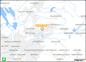
Modbury (South Australia, Australia)Modbury is a town in the South Australia region of Australia. An overview map of the region around Modbury is displayed below.
regional and 3d topo map of Modbury, Australia ::
Modbury airports ::
The nearest airport is ADL - Adelaide Intl, located 18.7 km south west of Modbury.
Nearby towns ::
Hope Valley (1.5km east) //
Gilles Plains (3.6km south west) //
Ingle Farm (4.6km west) //
Campbelltown (5.8km south) //
Stradbrooke (5.8km south) //
Teatree Gully (4.9km east) //
Northfield (4.9km west) //
Montacute (7.2km south east) //
Golden Grove (7.2km north east) //
Salisbury (8.7km north west) //
[all distances 'as the bird flies' and approximate]  Places with similar names to Modbury, Australia ::
Disclaimer :: Information on this page comes without warranty of any kind |
||
|
Where is Modbury? Elevation and coordinates ::
Latitude (lat): 34°50'0"S Longitude (lon): 138°41'0"E
Elevation (approx.): 108m (map arrows pan, magnifying glasses zoom) |
||
|
Visiting Modbury? Hotel/Accommodation ::
Book a hotel in Modbury Travel Guide ::
Buy a travel guide for Australia rental cars ::
car rental offers GPS waypoint ::
download a GPX waypoint (PoI) of Modbury for your GPS receiver
|
||