|
search place name
|
||
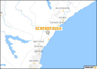
Scarborough (New South Wales, Australia)Scarborough is a town in the New South Wales region of Australia. An overview map of the region around Scarborough is displayed below.
regional and 3d topo map of Scarborough, Australia ::
Scarborough airports ::
The nearest airport is CDU - Camden, located 34.9 km north west of Scarborough.
Other airports nearby include BWU - Sydney Bankstown (38.1 km north), SYD - Sydney Intl (41.3 km north east), RCM - Richmond (75.5 km north), CBR - Canberra (197.8 km south west), Nearby towns ::
Coledale (1.9km south) //
Wombarra (1.9km south) //
Clifton (2.4km north east) //
Coalcliff (3.6km north east) //
Austinmer (4.8km south west) //
Stanwell Park (4.8km north east) //
Thirroul (6.3km south west) //
Otford (7.2km north east) //
Bulli (8.0km south) //
Woonona (8.0km south) //
[all distances 'as the bird flies' and approximate] 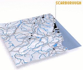 Places with similar names to Scarborough, Australia ::
// Scarborough (ZA)
// Scarborough (US)
// Scarborough (US)
// Scarborough (US)
// Scarborough (BB)
// Scarborough (JM)
// Scarborough (AU)
// Scarborough (CA)
// Scarborough (AU)
// Scarborough (GB)
Disclaimer :: Information on this page comes without warranty of any kind |
||
|
Where is Scarborough? Elevation and coordinates ::
Latitude (lat): 34°16'0"S Longitude (lon): 150°57'0"E
Elevation (approx.): 342m (map arrows pan, magnifying glasses zoom) |
||
|
Visiting Scarborough? Hotel/Accommodation ::
Book a hotel in Scarborough Travel Guide ::
Buy a travel guide for Australia rental cars ::
car rental offers GPS waypoint ::
download a GPX waypoint (PoI) of Scarborough for your GPS receiver
|
||